Milesopedia recommends this card from Scotiabank

Scotiabank Passport™ Visa Infinite* Card
🇨🇦
Up to 40,000 Points Ends Jul 1, 2024
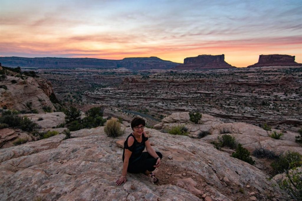
I first set foot on American soil during a solo trip in 2008 to Arizona, Utah, Nevada and California. More than 3,800 km between my thoughts and my amazement for this country that is the United States! It was an unprecedented love affair. This country attracts me like a magnet. For this 4th visit to our southern neighbours, I prepared THE trip which is without any doubt, the most beautiful one I have done so far. This trip was very special to me.
My parents live far away, in Gaspésie. To celebrate their 60th birthday and wedding anniversary, why not spend some quality time with them? Having never travelled, I told them about my plan to go and show them the American West. Project accepted, two years to collect their pennies and in June 2018, we left as a family! Here is the journey of this perfect trip that will remain engraved in our memories for a long time!
Our Travel Guide to the American West
On the menu: several national parks over a period of 14 days. Itinerary carefully prepared to suit and respect the physical condition of each member of the family. I’m sharing with you the websites I frequently check to get inspired and prepared.
I would like to take this opportunity to mention that it is essential to check the official websites of the parks to read the warnings. Work may be in progress, there may be a risk of rock falls, snowfalls, road closure, etc.
Day 1 and 2 - Yellowstone, Wyoming
- Highlight: A sleeping super-volcano
- Itinerary: Bozeman – Oldfaithful Lodge
- Driving time : 3h
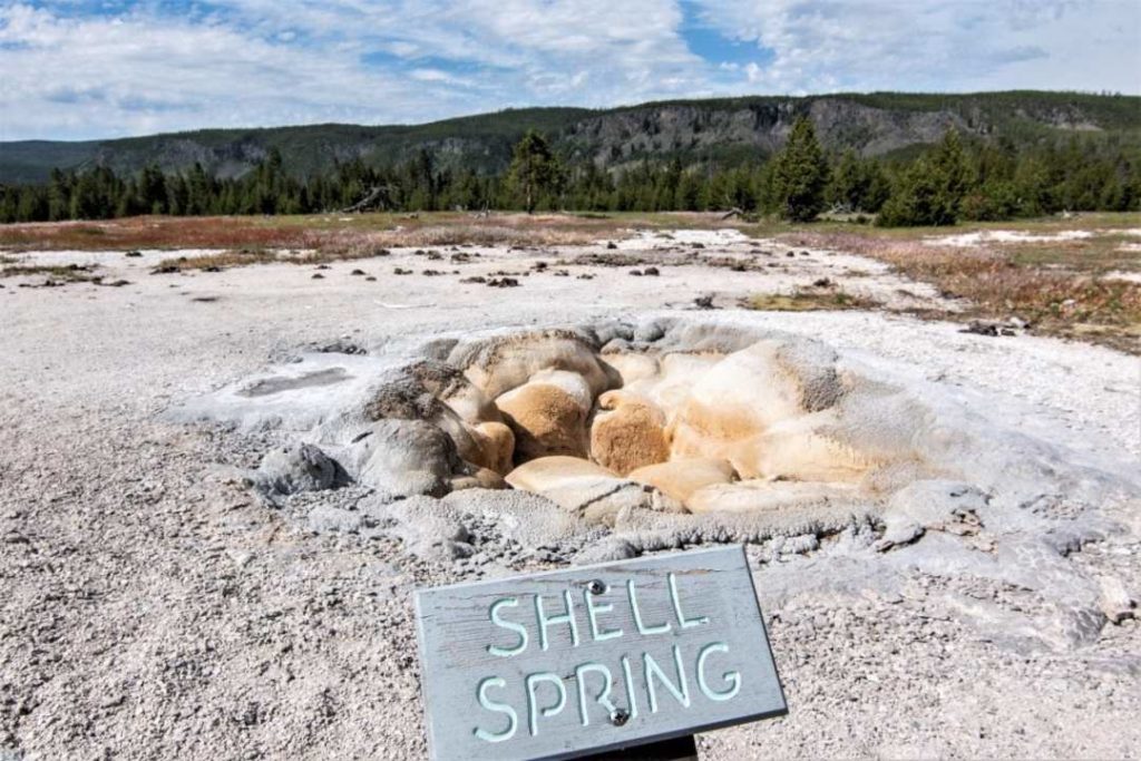
Located in the state of Wyoming, Yellowstone is a fascinating place, in every sense of the word! Yellowstone Park covers an area larger than Corsica! It’s huge! It is a super-volcano that last erupted 70,000 years ago. And we’d like it to stay that way. It is being watched very closely by experts, because if it wakes up, it would be one of the worst natural disasters on our planet.
According to scientists, if the Yellowstone volcano awakens, the United States would be plunged into a “nuclear winter.” It would release 3 meters of ash and its thick smoke would hide the sun for several years! It’s very scary.
But let’s stop being afraid for a moment and look at this magnificent place with its exceptional colours, impressive geysers and fantastic scenery, which is what Yellowstone offers us.
We flew from Montreal to Bozeman, Montana. As soon as we got out of the plane, we could already see the beautiful mountains all around. It promises to be great! Bozeman seemed to me the most logical starting point as it is near the northern entrance to Yellowstone Park. The Mammoth sector is located in the north of the park, and arriving from the north was the most logical route to take.
- Driving time Bozeman – North entrance of Yellowstone National Park: 1h30
The road is really superb! For mountain lovers like me, Montana is definitely a place I’d like to set foot in.
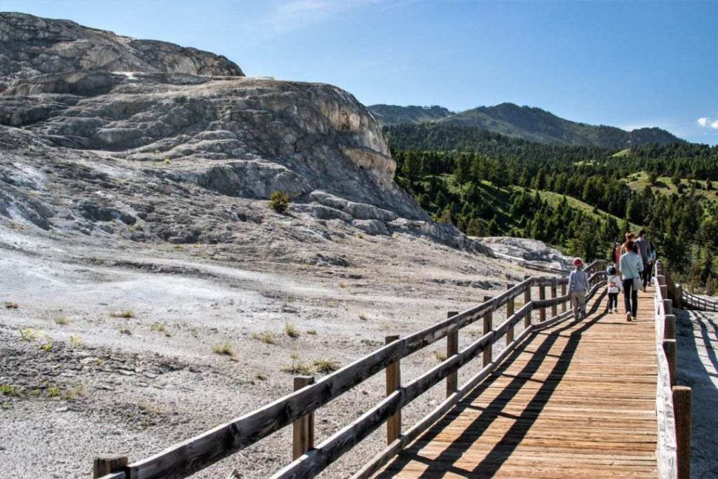
As soon as we arrive at the North entrance of the park, the wildlife is already close by.
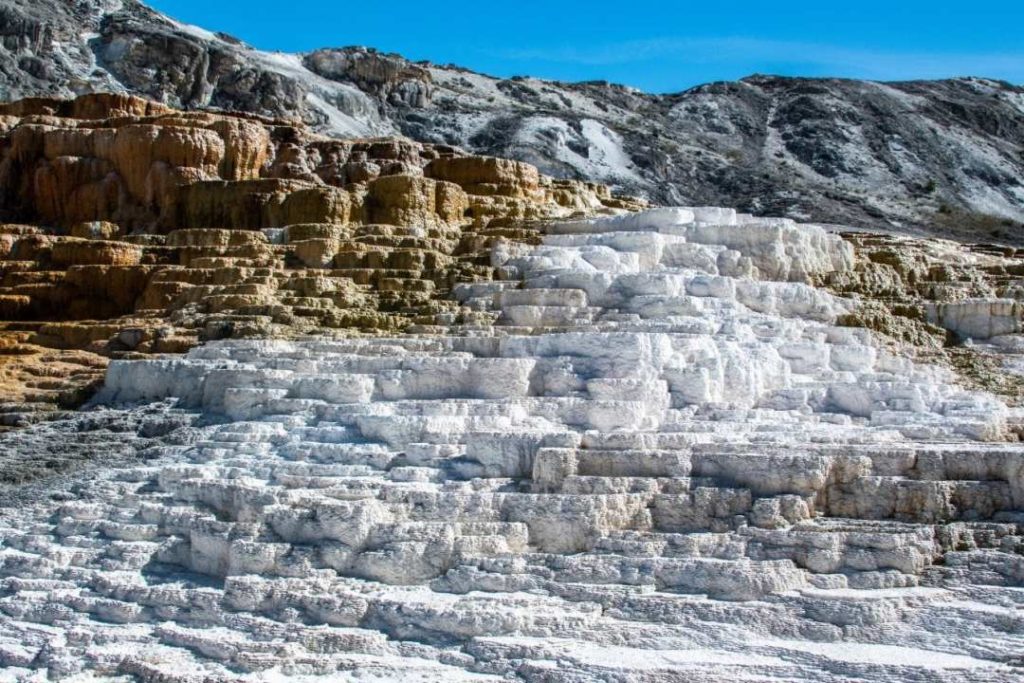
After paying your park entrance fee, you will have about 10 minutes to walk to Mammoth Hot Springs from the North entrance.
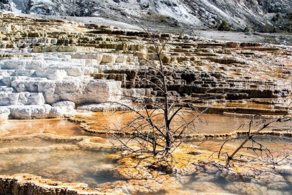
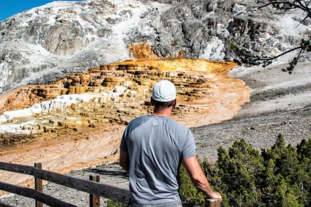
Plan to spend at least 2 hours there to have time to check out the superb limestone terraces that make this place so fantastic! Wooden bridges are built all around to facilitate walking. Here, life seems dead and alive at the same time.
- If you have some time in your day, you can go see a section called Upper Terrace Drive in 15 minutes by car. Needless to say, it is much more beautiful to walk there!
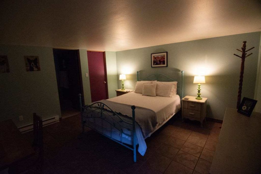
Accommodation
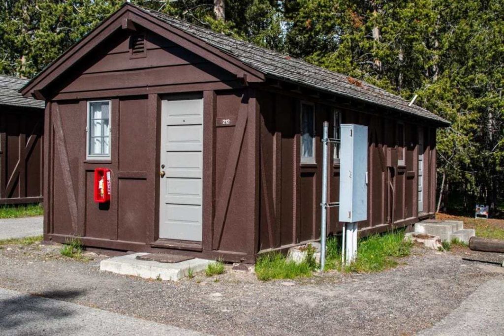
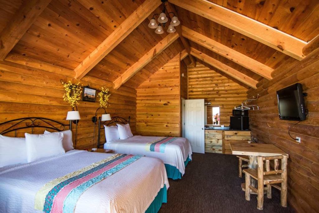
After this great introduction to the park, we headed to our accommodation in the Old Faithful area, the Oldfaithful Lodge Cabins. Small rustic cabin, clean and comfortable. The toilets and showers are shared and are very clean.
You are 1 minute walk from the Old Faithful geyser.
- Price: 2 nights/4 pers : 295$ US
- Driving time from Mammoth hot springs: 1h30
- Book at least 6 months in advance. I had booked a year in advance.
In the evening, we went to see the show offered by the Old Faithful Geyser. The time of its eruption is written down at the nearby reception desk. It’s beautiful during the day, but at sunset it’s really magnificent!

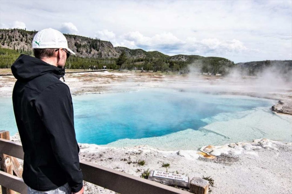
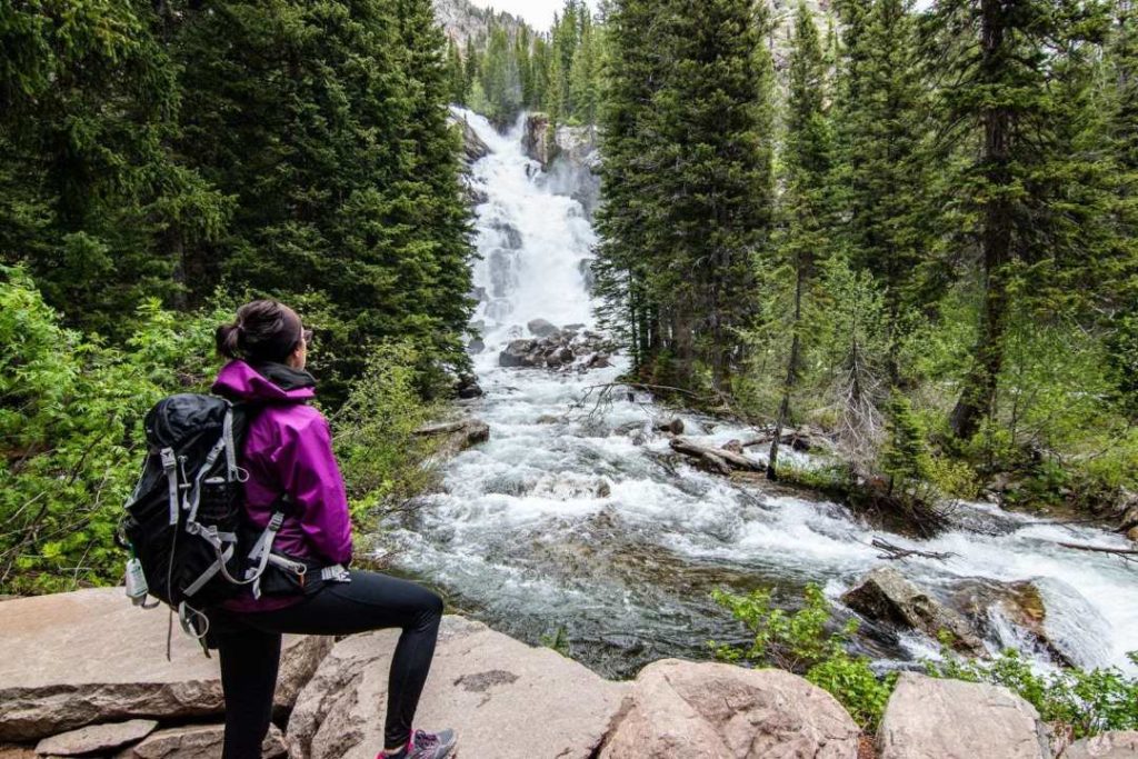
Day 2 - Biscuit Basin and Grand Prismatic Springs, Yellowstone
From our accommodation at Old Faithful Lodge, Biscuit Basin is a 10 minute drive. Don’t go too late in the day to be able to find parking not too far away.
A nice walk on a wooden pontoon will allow you to see several pools in activity and maybe even a geyser in eruption!
Sapphire Pool gets us started on the right foot. What a beautiful pool! The turquoise blue water is so clear that we can see the depth of it.
- Time to walk the wooden pontoon: 45 minutes
We continue our little walk and we cross several holes letting out fumaroles, as well as several different pools. The smell of sulphur is very present.

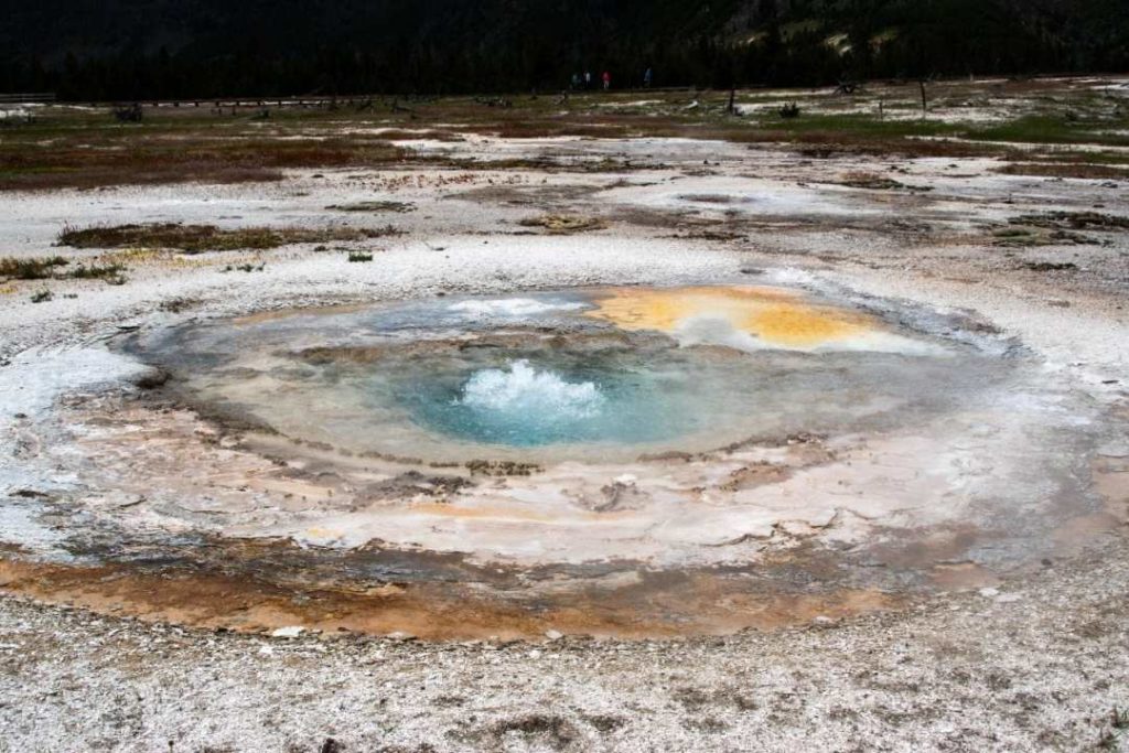
The colours are remarkable all around! Everything seems both alive, and dead. They call these environments ‘extremophiles’. That is, when normal living conditions are lethal to most other organisms, such as very high temperatures, acidic or highly saline environments.
After checking out several pools, you can continue your walk towards Mystic Falls. We didn’t know at the time how long the trail was. Since my father had hurt his ankle a few weeks before, we went with the beat of the moment.
So we didn’t do the whole loop and we didn’t see the fall. Still, the part we walked was superb and certainly worth the trip to the Biscuit Basin Overlook! Peacefulness is a given, since few people walk this trail.
- Round trip time to Biscuit Basin Overlook: about 1 hour and 15 minutes
- Complete Mystic Falls loop: 4 km

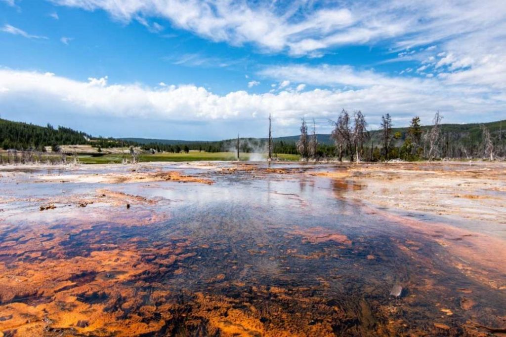
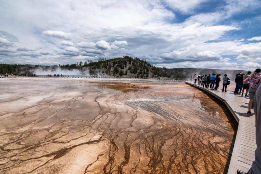
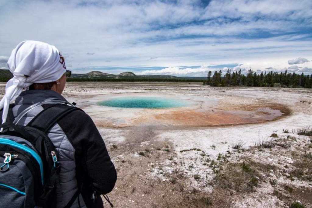
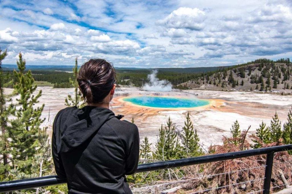
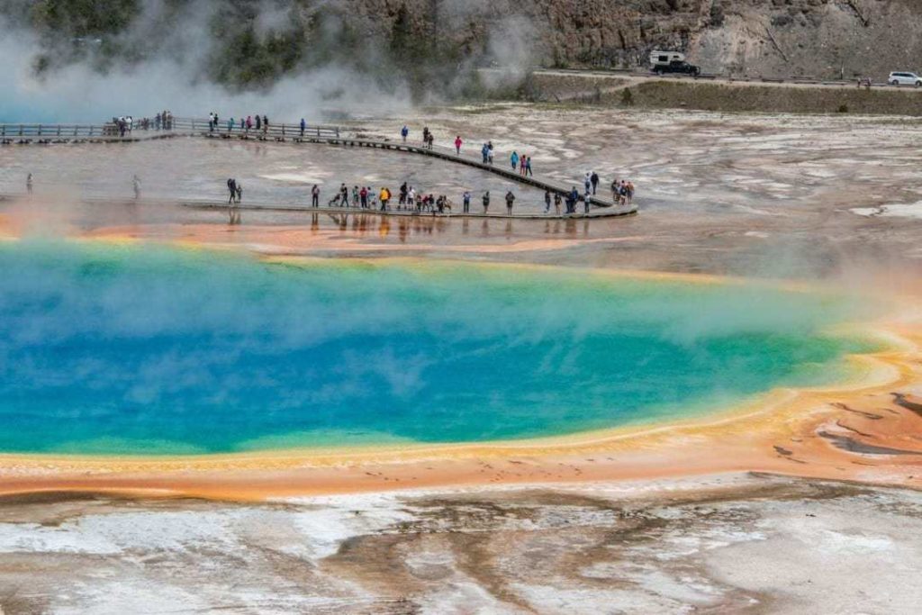
Grand Prismatic Spring
A huge hot spring composed mainly of sulphur and iron oxide, the Grand Prismatic dazzles with its blue, green and yellow colours. Its water heats to 70 degrees Celsius, making it the largest hot spring in America.
There are two ways to see the Grand Prismatic: from the air or walking around it.
We started by walking around. This way, it is impossible to see it in all its splendour. But we can see its beautiful colors, its smell and its composition.
- Time allowed for this walk: 1 hour
- Length: 2 km
- Parking: Midway Geyser Basin

View from the air
To view the Grand Prismatic from the air, you must park 2 km south and take the Fairy Falls trail.
- Time: about 1 hour
- Distance: 1.6 km round trip from the parking lot
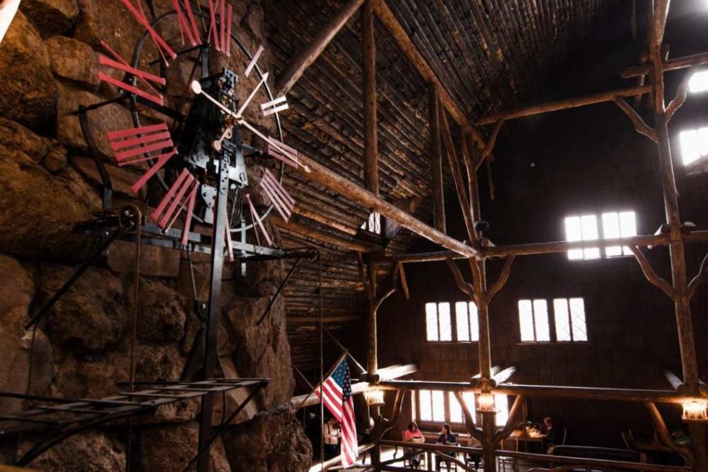
Old Faithful Inn
Rustic, grandiose, splendid hotel! You have to be inside this majestic place to understand. The architecture is sublime. Its hearth is 25 meters long and weighs 500 tons.
- 1 night in this majestic hotel costs about $400 USD per night.
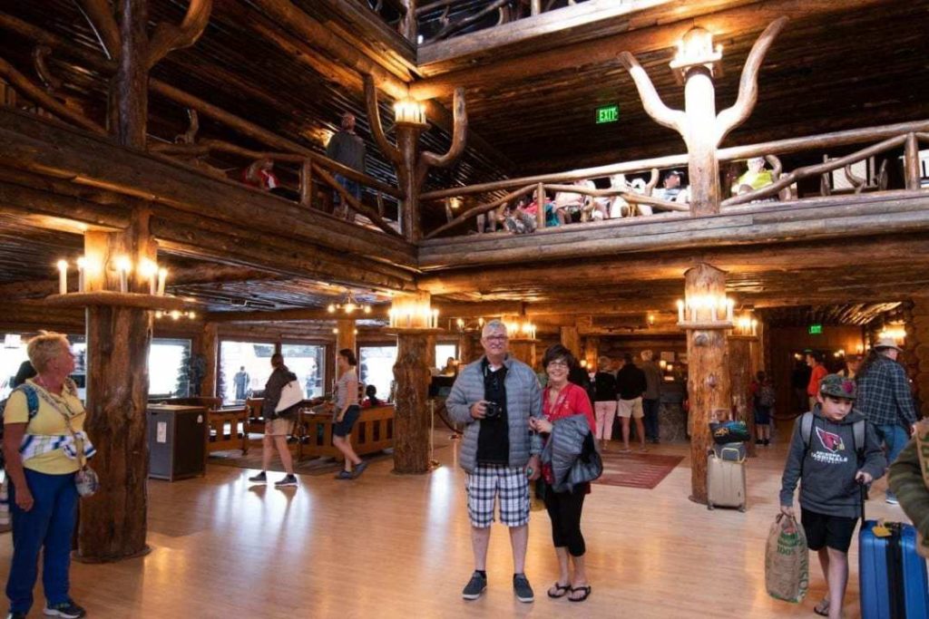


We had dinner at the hotel restaurant, a booking made 2 months in advance. Since we had booked accommodations in the park, we could book 60 days in advance for the restaurant. This gave us priority in choosing a restaurant in Yellowstone Park and the time of booking.
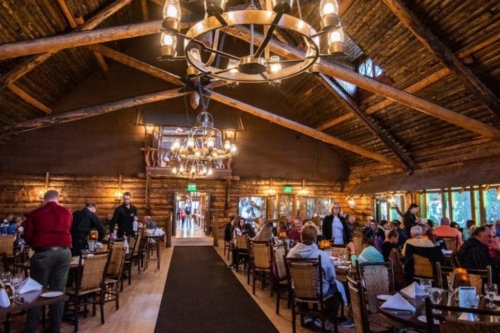


The prices are a bit high, which is normal since you are directly in the park. Prices of similar restaurants in the area are equivalent. They prioritize local ingredients and products. Many organic products available.
Very good service. The osso bucco was delicious, the salmon was a little overcooked and the vegetables were cold on every plate.
This concludes our time in Yellowstone! In conclusion, I recommend two days or more to visit this park. This place is huge!
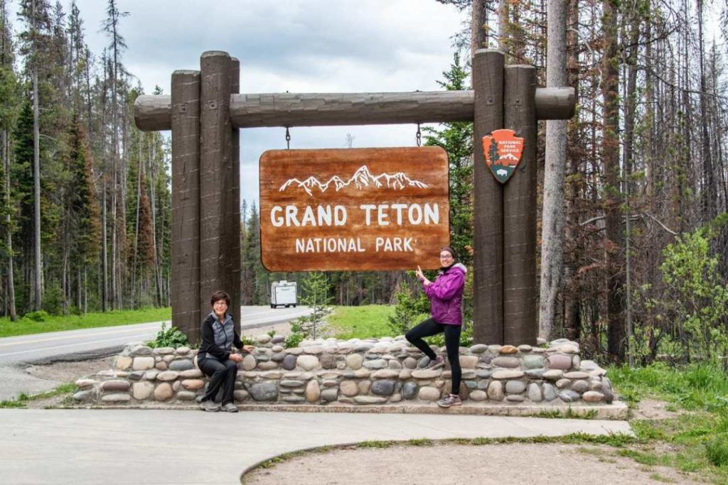
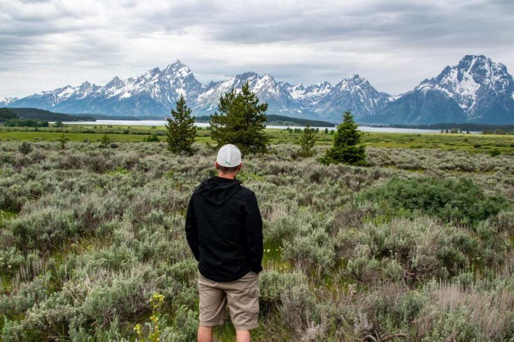
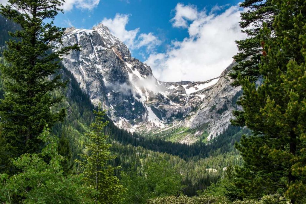
Grand Teton National Park - Wyoming
- Itinerary: Oldfaithful lodge – Grand Teton National Park: 45 minutes
- Itinerary: Grand Teton – Driggs – Idaho: 1h15
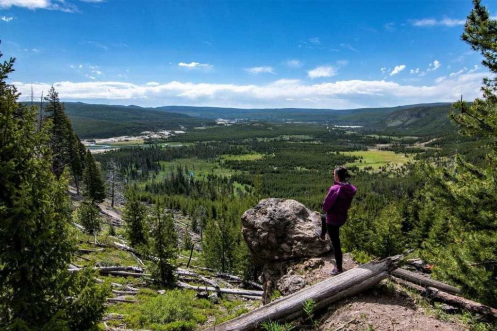
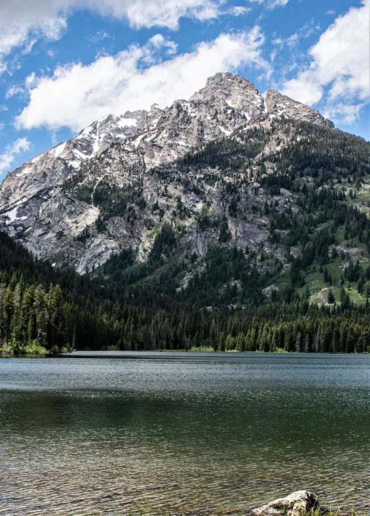
Part of the great Rocky Mountain range, Grand Teton National Park will leave you speechless at the beauty of its million-year-old glaciers. Its name comes from a French Canadian who thought that the 3 highest peaks were strangely similar to the female anatomy! So that’s the origin of its name. Now we can make all the puns we want.
This park was a real favourite for me and I plan to go back for a nice hike near the glaciers. Mountain lovers will be especially happy.
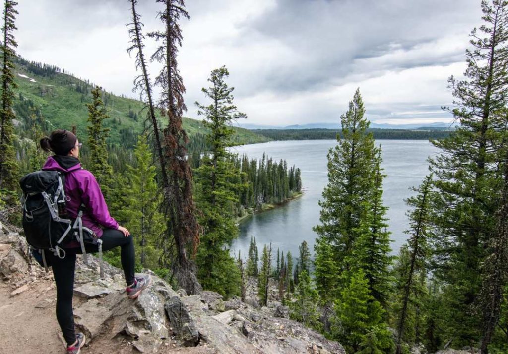
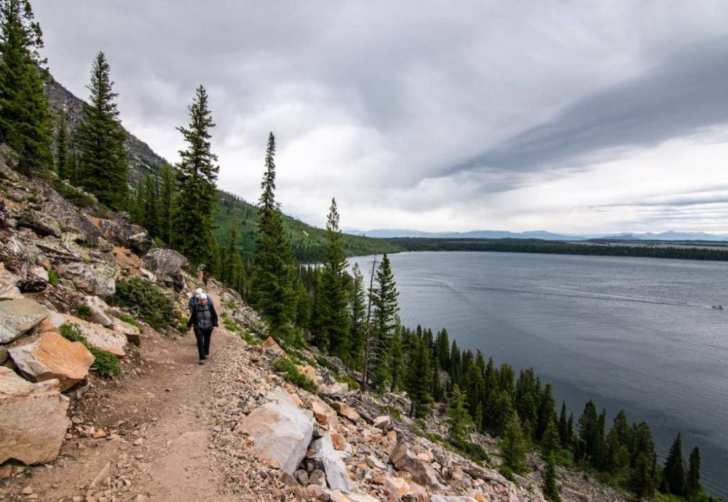
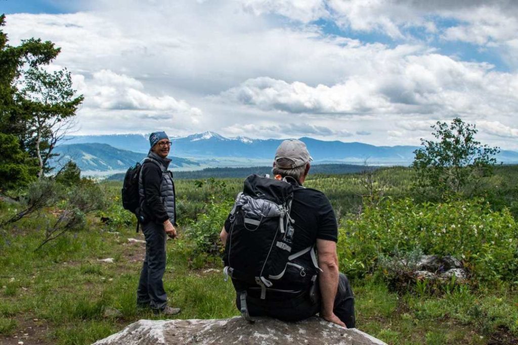
Day 3 - Jenny Lake
We left after lunch for Yellowstone National Park to see this fabulous park. The road to get there is very pretty and will give you a taste of the mountains before you get there.
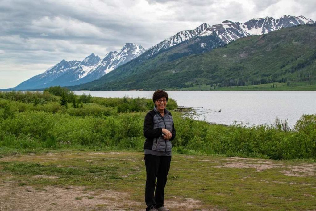
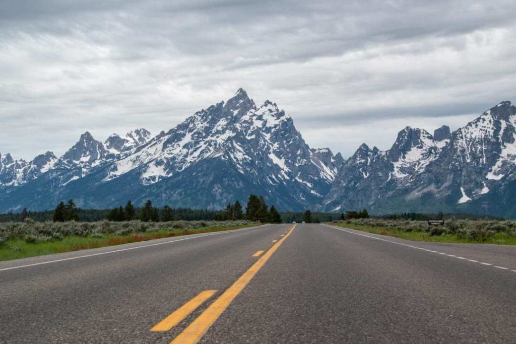
Weather wise, it was a grey day, but no rain and the clouds did not hide the mountains. So everything was perfect.
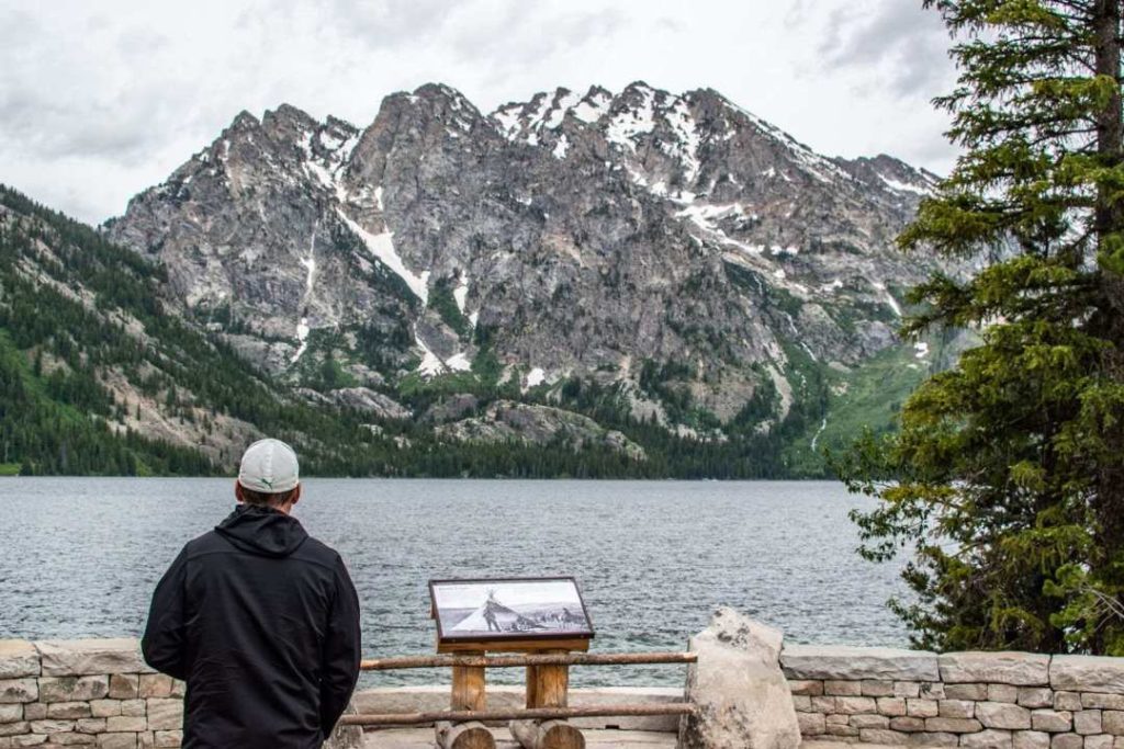
Our goal for the beginning of the day was to visit Jenny Lake, despite the fact that this place receives many visitors.
This lake was formed about 12,000 years ago by a glacier and is located at an altitude of 2,067 metres. The landscape of the lake is of great beauty and it is the starting point for short and long hikes.
Planning your visit to Jenny Lake
First of all, the site has been under construction for a while (June 2018 ). Restructuring of the site and some of the paths. It’s best to check beforehand on the park’s official website to see what is accessible and what is not.
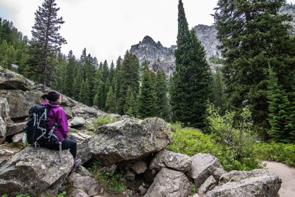
There are several options available to you, depending on the time you have and your level of fitness. There are some really great hikes to do in the area like Cascade Canyon or Paintbrush Canyon.
How long will it take?
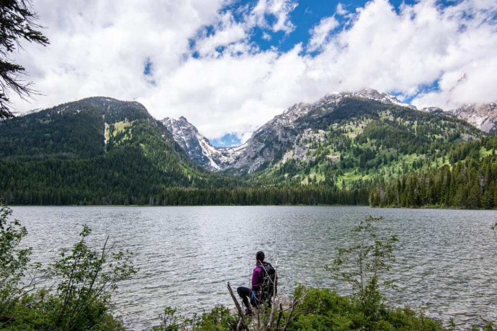
We took the shuttle boat, did Hidden Falls, Inspiration Point and walked back along the trail on the left side of the lake. We took our time and did it in about 2h-2h30.
The shuttle boat
There is a shuttle boat every 15 minutes that crosses the lake to bring you to the Hidden Falls trailhead, and to Inspiration point. You can purchase a one-way or round-trip ticket.
Here are the prices in US dollars:
15$ – adult round trip (12 years to 61 years)
9$ – adult one way
8$ – child round trip (2 years to 11 years)
6$ – child one way
12$ – Senior round trip (62 years and older)
FREE for children under 2 and adults over 80 years old.
Hiddens Falls/Inspitation Point Trail

Probably the most popular trail, you can take the shuttle boat or walk around Jenny Lake.
- From the shuttle boat deck and back: 2.9 km
- Departure to the left of the lake to get there on foot: about 5 km
We took the shuttle boat only to get there, we came back walking the left trail from Jenny Lake.
After seeing the waterfall, we turned back to take a trail that leads to Inspiration Point for a great view of the lake. Although Jenny Lake attracts a lot of visitors, I enjoyed visiting these places that are accessible to everyone!
Day 4 - Jackson Hole
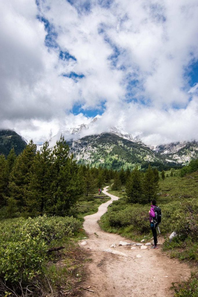
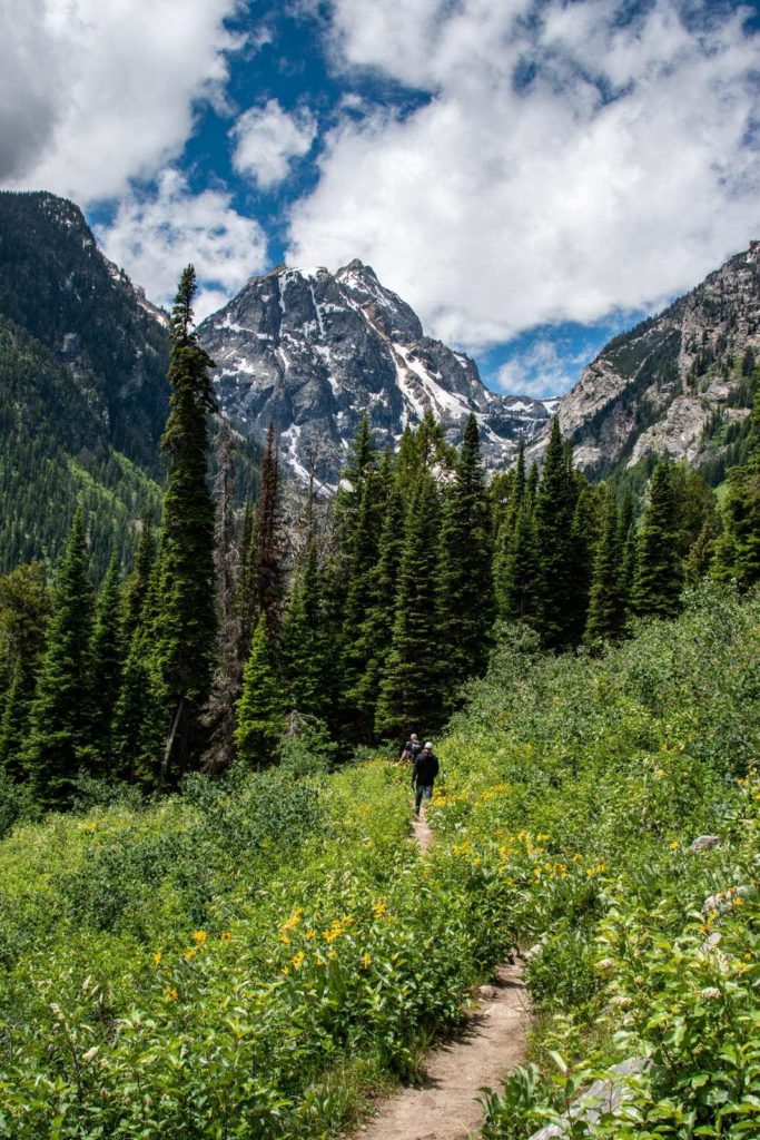
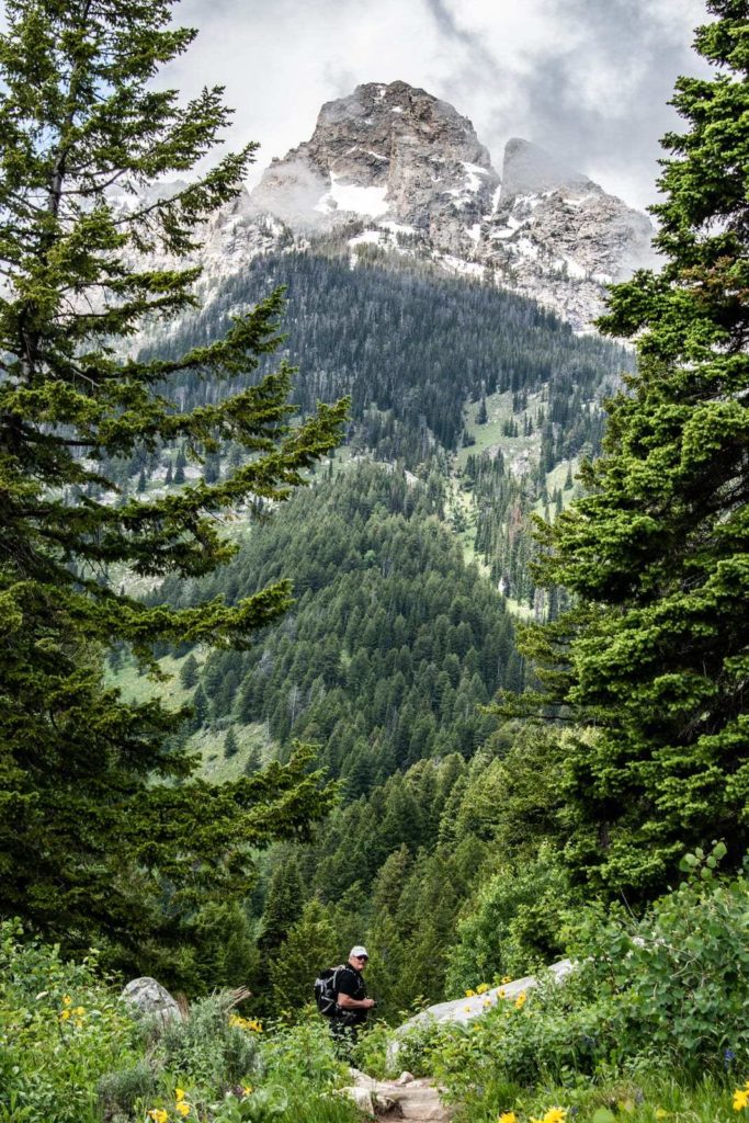
It was wet all night and morning. Fortunately, the rain stopped at the end of the day. This allowed us to go for a nice walk at Taggart Lake.
Taggart Lake Trail/ Bradley Lake - Grand Teton National Park
- Difficulty: easy
- Height difference: about 120 meters
- Time: 2h30-3h
- Length: 8 km (what I walked, in red, on the map)
- Access to the parking lot is on Grand Teton Road not far from Jenny Lake
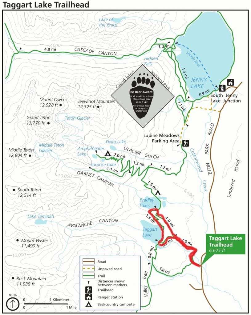
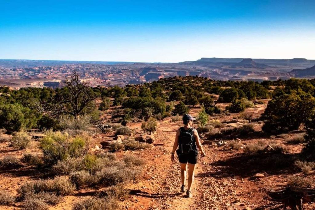
We walk a little in the forest towards the Grand Teton glaciers. The forest dissipates and lets us see some parts of the mountains. Parts of the trail are in the forest and others are open-air.

You should carry a bear bell, make noise or carry a spray with you.
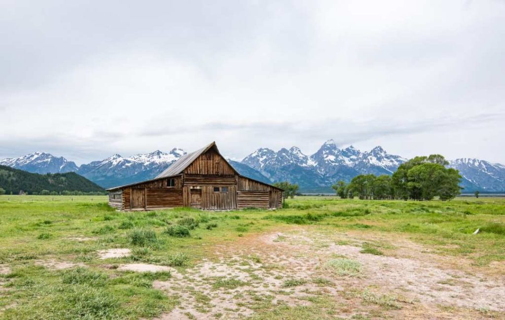
On the way back from Taggart Lake, we went to see theiconic historic house in the Mormon Row district. This house is very photographed. Its location with the Grand Teton Mountains behind it makes it popular.
- Free
- Located on Antelop flats (closed from Nov. to May)
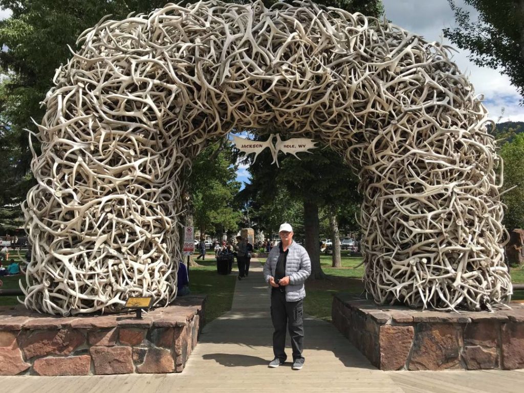
Jackson Hole
A short stop was necessary in the small tourist town of Jackson Hole. Very nice to walk around and find souvenir shops. You will find some nice restaurants there. The atmosphere is very pleasant, but we didn’t stay long enough to talk about it in detail.
Accommodation
We chose an accommodation in Driggs in the state of Idaho. It takes about 1 hour and 15 minutes to get there.
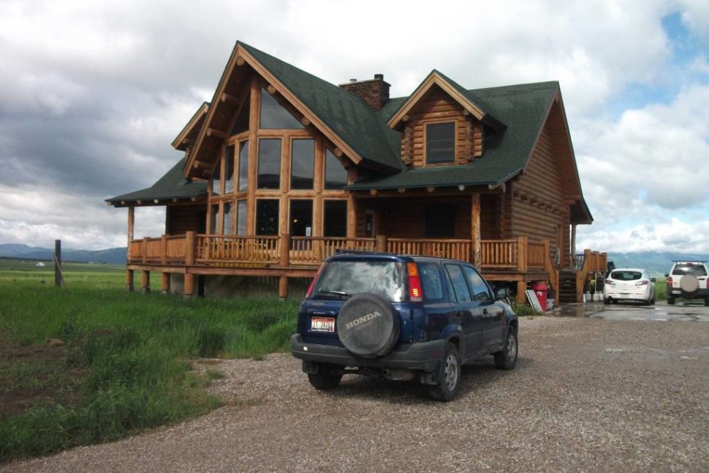
Why choose a remote accommodation? I didn’t find affordable accommodation in the park. We could have stayed in the town of Jackson Hole (quite expensive too) but I fell in love with a B&B type hostel in a log cabin. This place is called Teton hostel Hideway B&B. Beth the owner is very charming, welcoming and available.
This place is located in Driggs next to the farmers’ fields. At first glance, when we first arrived, we wondered if we were in the right place.
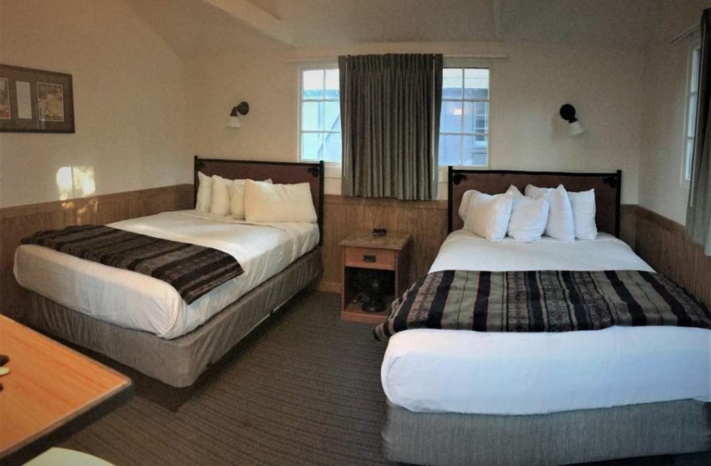
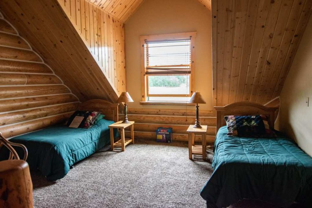
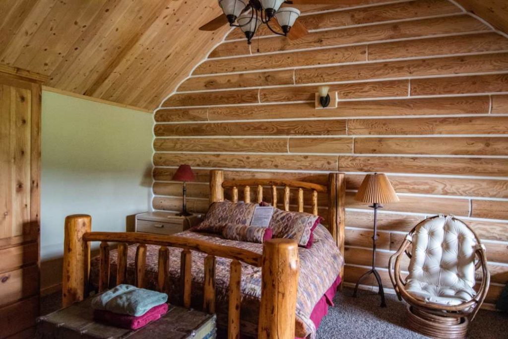
In this house, there are dormitories in the basement and 2 private rooms upstairs. One of them has a private bathroom. This is the one we had. 1 queen size bed with 2 single beds.
Teton Thai, a restaurant not to be missed!
We went to eat at a great Thai restaurant in Driggs. Again, the name Teton is used. I guess the English might be amused by this too!
Perfect atmosphere, service and food. I recommend it.
Teton Thai website
Breakfast is included. In other words, Beth provides us with bread, fruit, coffee (1 coffee per person), eggs, cheese, juice, bagels, cereals and milk in her large kitchen. Fresh products to cook yourself. We loved the idea. Everyone washes their own dishes. It felt like home.

Day 5 - Antelop Island
- Route: Driggs – Layton – Antelop Island
- Time Driggs – Layton: 3h50, 425 km
- Time Layton – Antelop Island: 25 minutes
After visiting the 2 main parks in Wyoming, we drove south through Idaho from Driggs to spend one night only in Salt Lake City. We had a 6-hour drive and half a day to explore. A nice stop before reaching the Moab region.
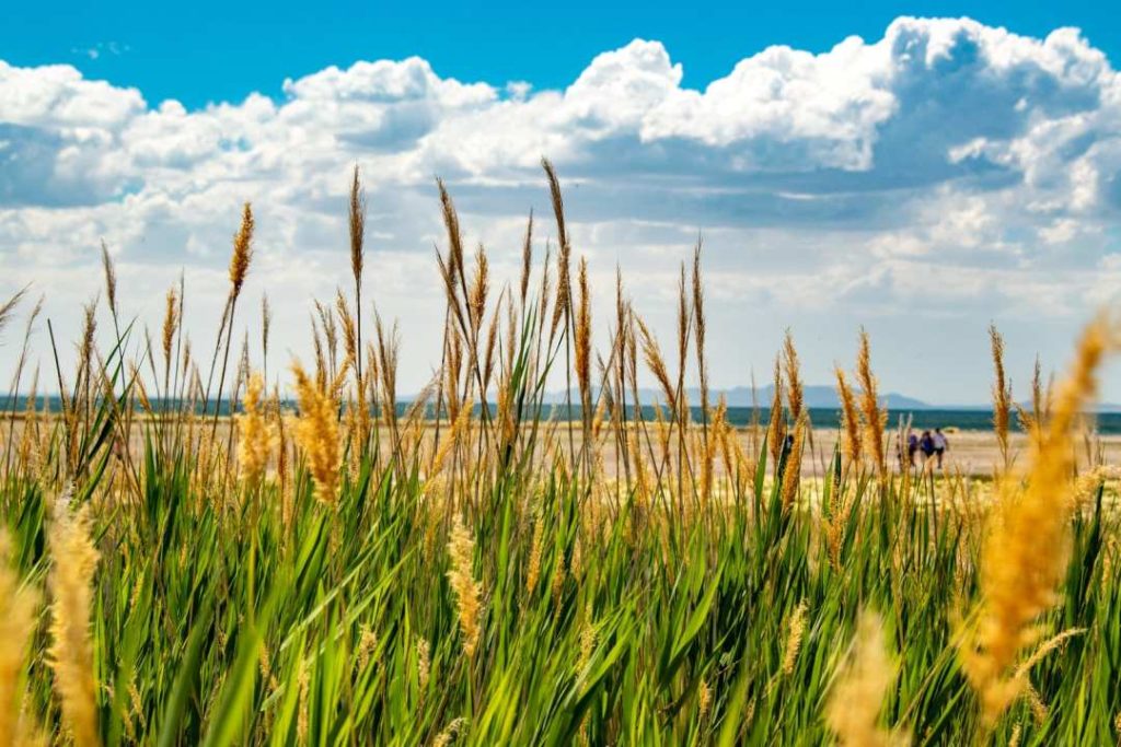
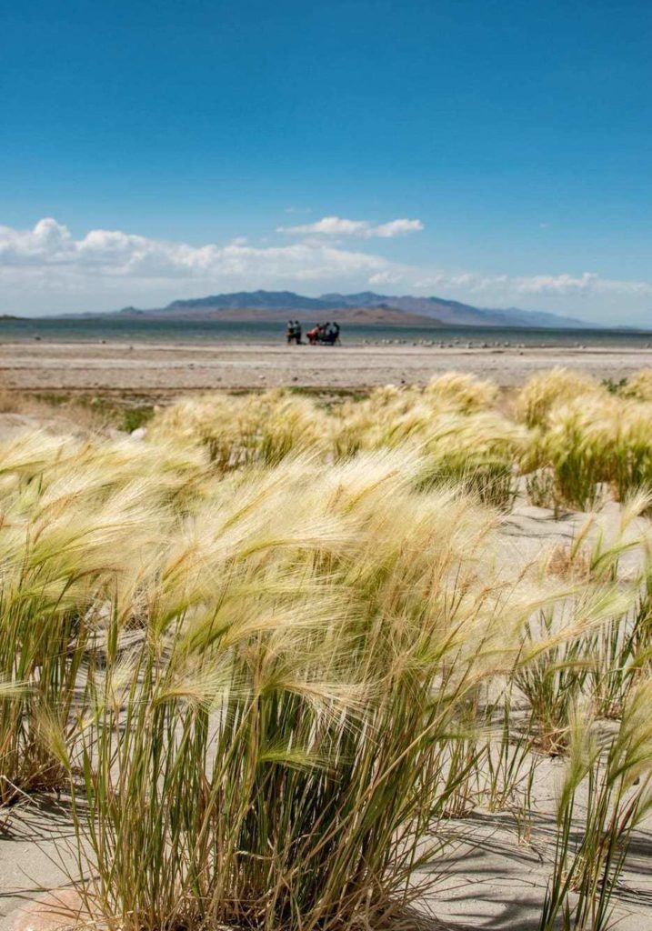
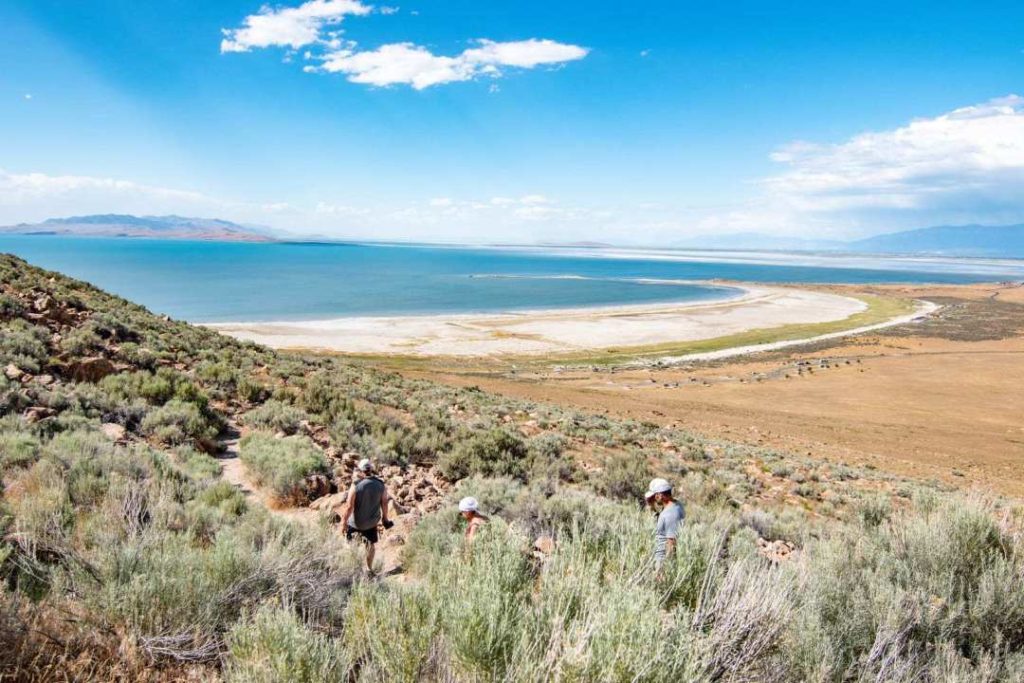
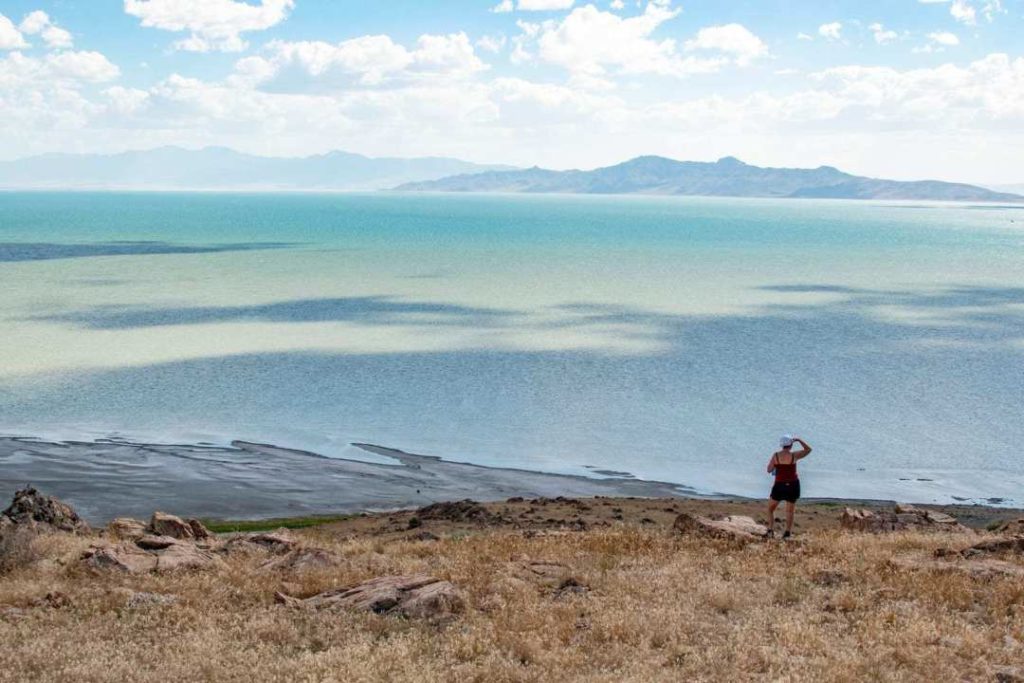
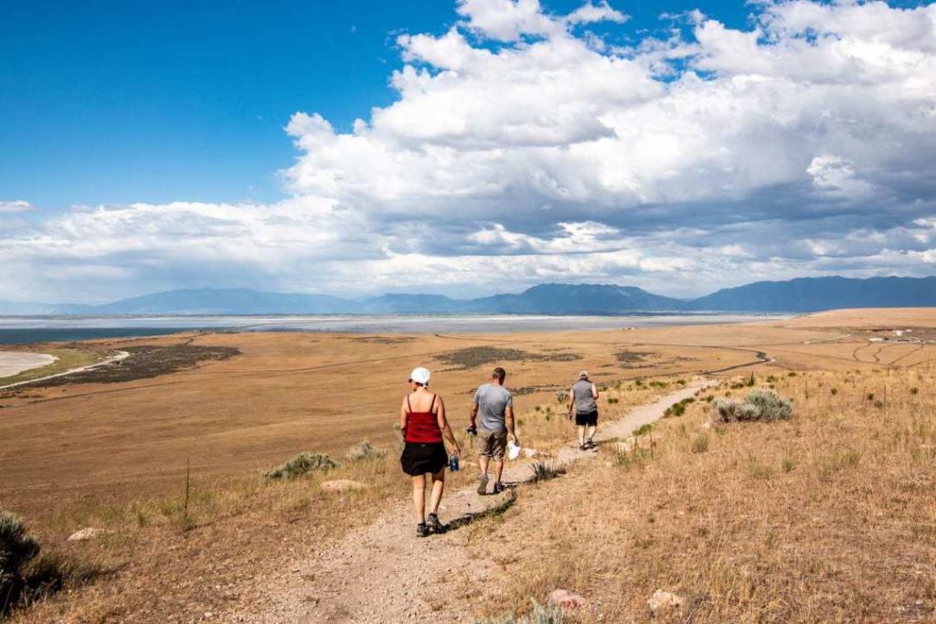
Antelop Island State Park is the largest of the 10 islands that make up the Great Salt Lake. A place that is a little less known, but which deserves our attention!
Prepare your visit to Antelop Island
- Opening hours: 6am to 10pm
- Opening hours November to February: 6am to 6pm
- Address: 4528 W. 1700 S., Syracuse, 84075
- The places are bigger than you think!
- Cost of entry to the park: 10$ US/car. American Beautiful card is not accepted
- Official website: Antelop Island State Park
- Camping is permitted in designated areas and advance bookings are required.
- I invite you to watch the show on the Great Salt Lake by Découverte. It’s very interesting to learn how the lake was formed, which different species are present, learn about the seasons and the utility of this lake located between mountains and salt flat. A must see!

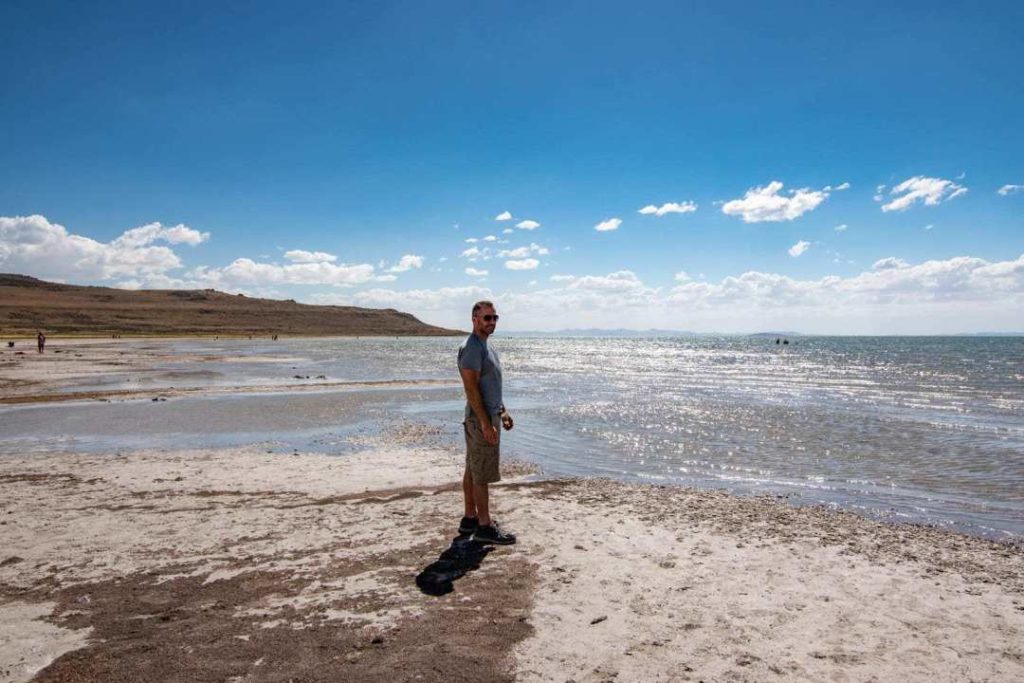
Bridger Bay
First, we went to soak our feet at Bridger Bay beach which is the Great Salt Lake. The water is 4 times saltier than the sea. If you enter the water, you will sort of float. There are showers not too far away to rinse off. Avoid getting it in your eyes!

Buffalo Point
Since we had little time to visit, we chose a short and easy hike near Bridger Bay called Buffalo Point.
- Level: easy
- Distance: 1.3 km
- Time: 1h – 1h30. Take time to contemplate!

Wildlife
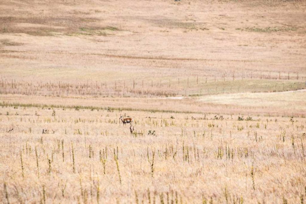
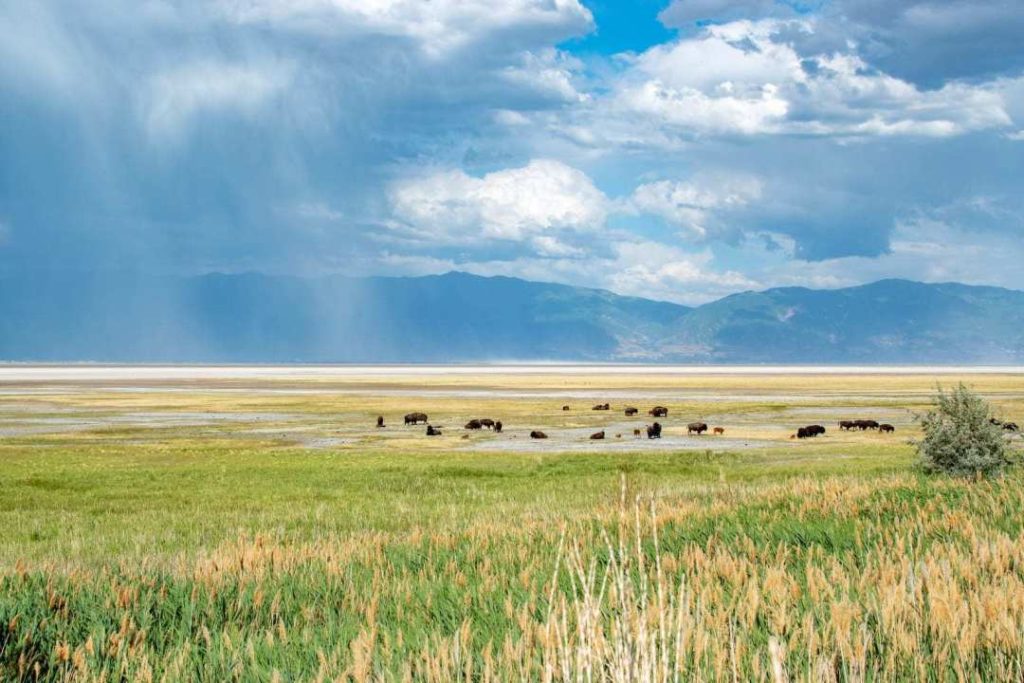
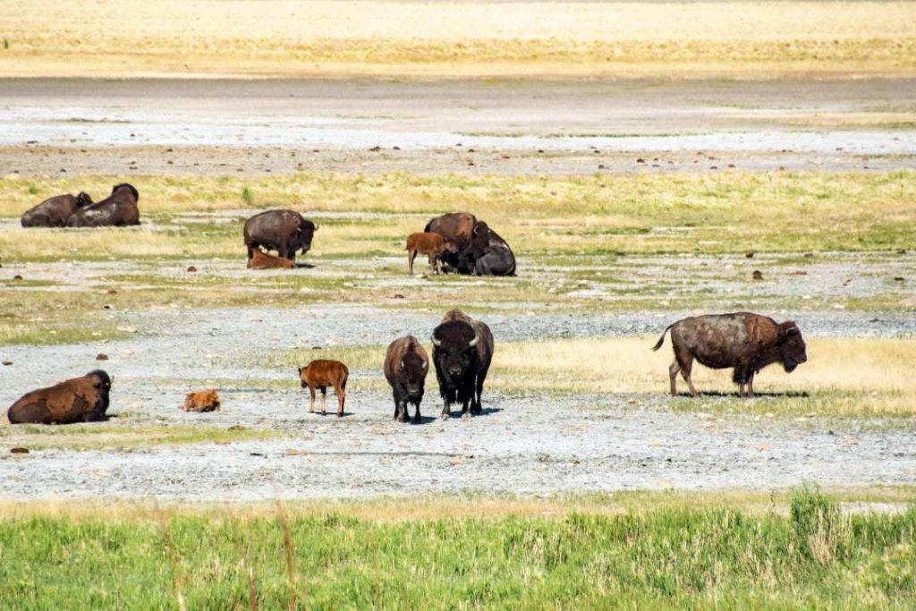
Antelop Island is home to a variety of wildlife including bobcats, bighorn sheep, coyotes, elk, and deer, as well as the largest bison herd in Utah, approximately 700 head. To observe these, a visit in the morning or late evening is best.
In order to observe the bison, we went to find out where they were at the visitor center. They will direct you to them.
We were treated to a beautiful display of nature, blue skies and rain clouds in the distance. We couldn’t ask for a better setting!
Accommodation
Our accommodation was located in the town of Layton, 25 km from Antelop Island. Strategic location to save time and avoid the traffic of the big city.
We booked a basement in Brenda’s house on the Airbnb platform. Brenda is truly an exceptional woman! You will feel like you are visiting a friend. There is a private bedroom in the basement and a double sofa bed. Everything was perfect.
- Lodging at Brenda’s to see the details : Harlow Haven
- Cost: $120 per night/4 people
- Everything was thought of, in the cupboard you have a fridge and everything you need to prepare lunches. You don’t even have to wash the dishes!
Days 6-7-8 - Moab Region
Moab was at the heart of our trip. Utah is now my favorite state in the US!
The Moab region has everything to seduce you. The road, the sunsets, the hikes, the hot air balloon rides, the horseback riding, etc… Impossible not to enjoy it!
- Itinerary day 6: Layton – Moab – Canyonlands – Dead Horse State Park.
- Time Layton – Moab: 4h, 412 km
- Itinerary Day 7: Moab – Arches National Park: 10 min
- Itinerary Day 8: Moab – Arches National Park – Canyonlands
- Time Moab – Canyonlands: 35 minutes
On the roads of Moab
I could put hundreds of pictures, you just have to be there. It is impossible to describe the splendour of the roads at every turn we took. I never thought I would see so much stunning scenery in one area!
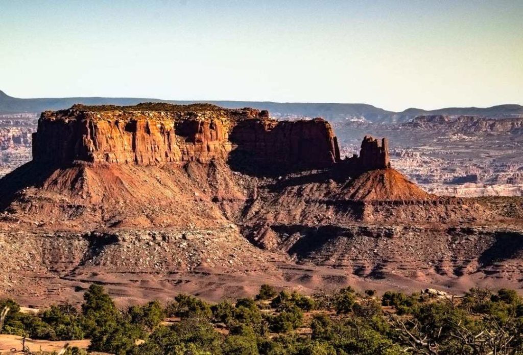
But I can’t not mention this viewpoint crossed on the way between Moab and Dead Horse Park : Merrimac and Monitor Buttes. We went there to watch the sunset.
- Exact address to enter in google map: 85CGJ7W7+5C
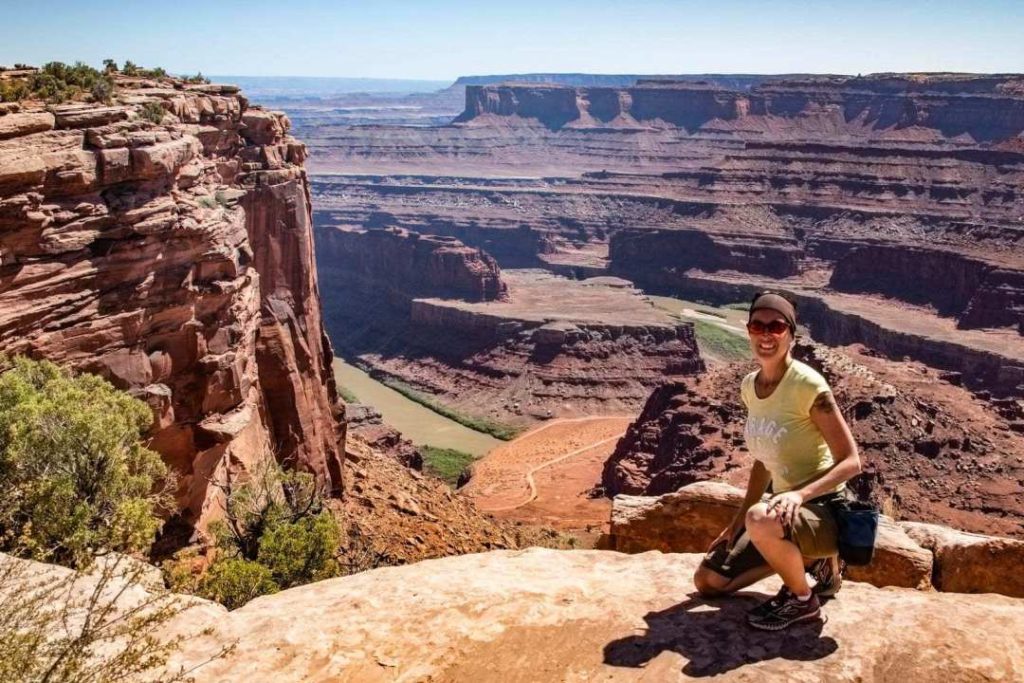
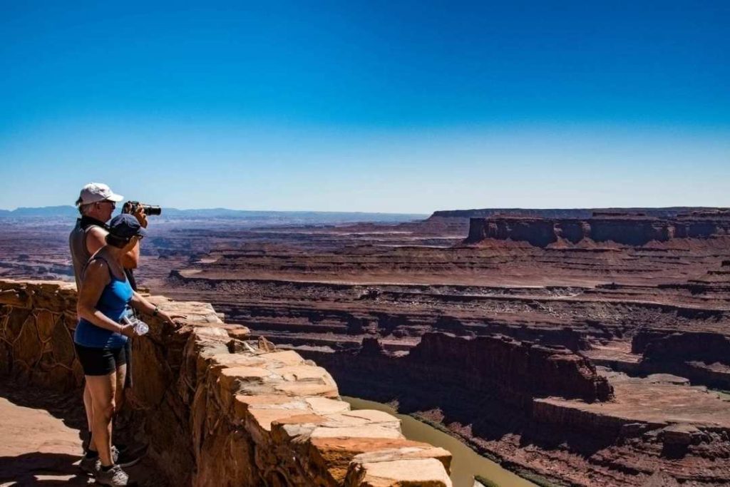
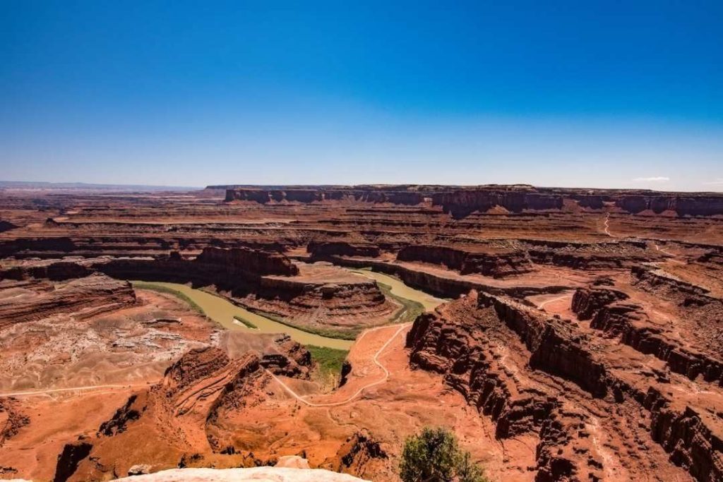
Dead Horse State Park - Moab
- Official website: Dead Horse State Park
- Cost: $20 USD/vehicle valid for 3 days.
- American Pass is not accepted
- From Moab, it’s about 45 minutes
- Time from Dead Horse Point to Canyonlands (Island in the sky): 20 minutes
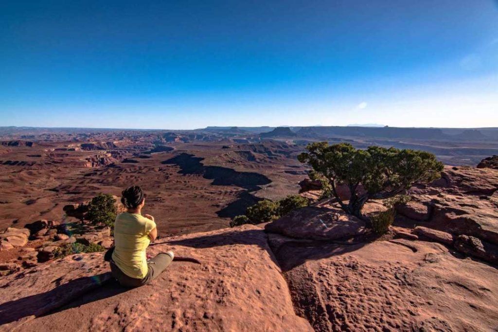
Wow! A beautiful place crossed by the Colorado River, Dead Horse Point is a wonder. No need to walk very far, the parking lot is right next to this beautiful view!
For the more adventurous, there is a 9 km hike to do, East Rim & West Rim Loop. The two trails make a loop.
Other short hikes are offered to get you away from the crowds. Go to the Visitor Center for advice.
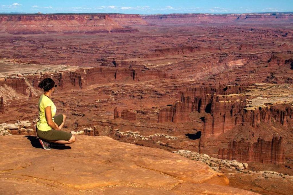
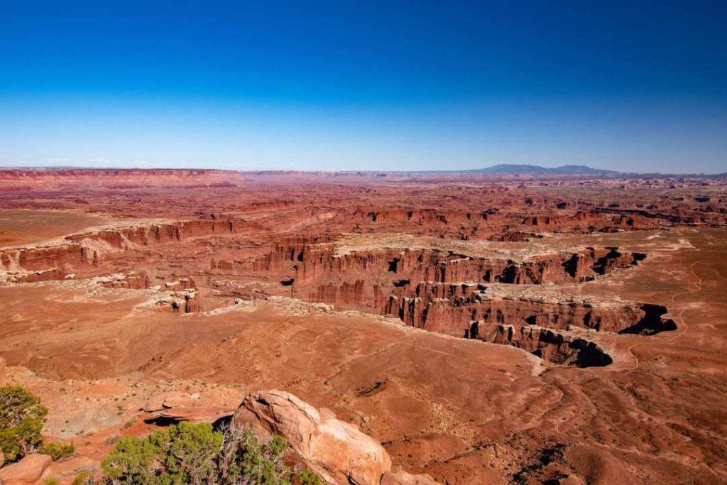
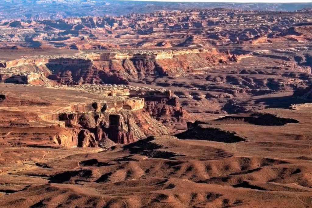
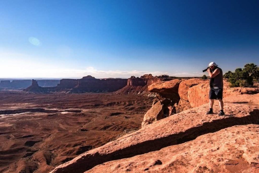
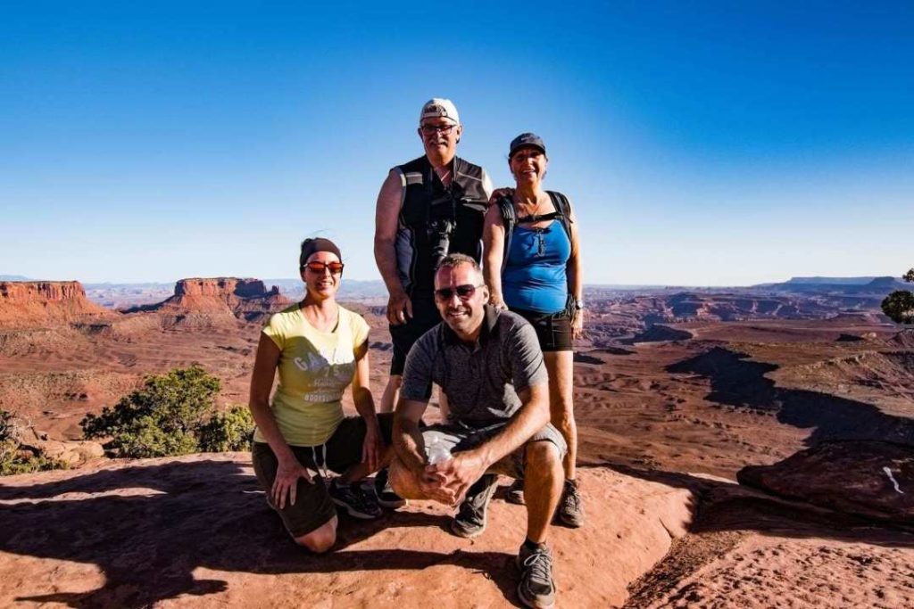
Canyonlands National Park
One of the most spectacular parks I’ve seen. What is surprising about this place of wide open spaces is that there are few tourists. All visitors are at Arches National Park! Good, because it’s very pleasant when there are fewer people. I would love to go back and get lost for a few days, and go on a long hike!
- Official website: Canyonlands NPS
- Cost: $30USD/vehicle, valid for 7 days
- Time: from Moab, about 35 minutes
This park is huge! It is divided into 3 zones:
- Island in the Sky
- The Needles
- The Maze (accessible only by 4×4 or hiking trail)
The most popular area is Island in the Sky. This is the one we visited.
- Download the Island in the Sky map. Here you will find all the necessary information about the suggested hikes.
- The Maze map
- The Needles map
First stop, I’m not sure of the name, but I think it’s Grand View Point Overlook. This view is straight from the parking lot! It’s like being right in the canyon. This is an amazing place.
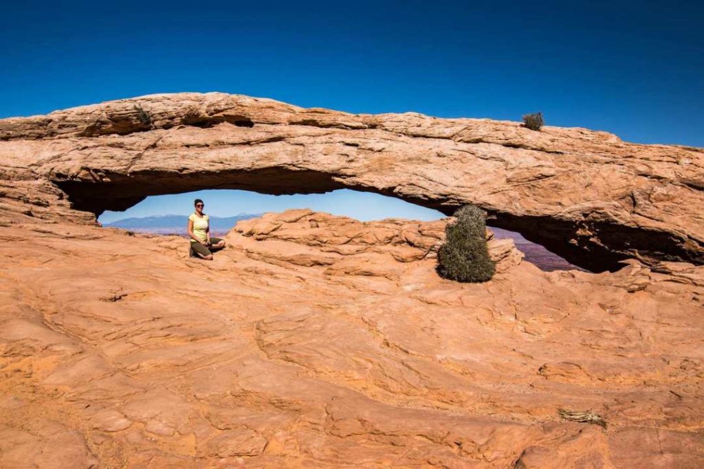
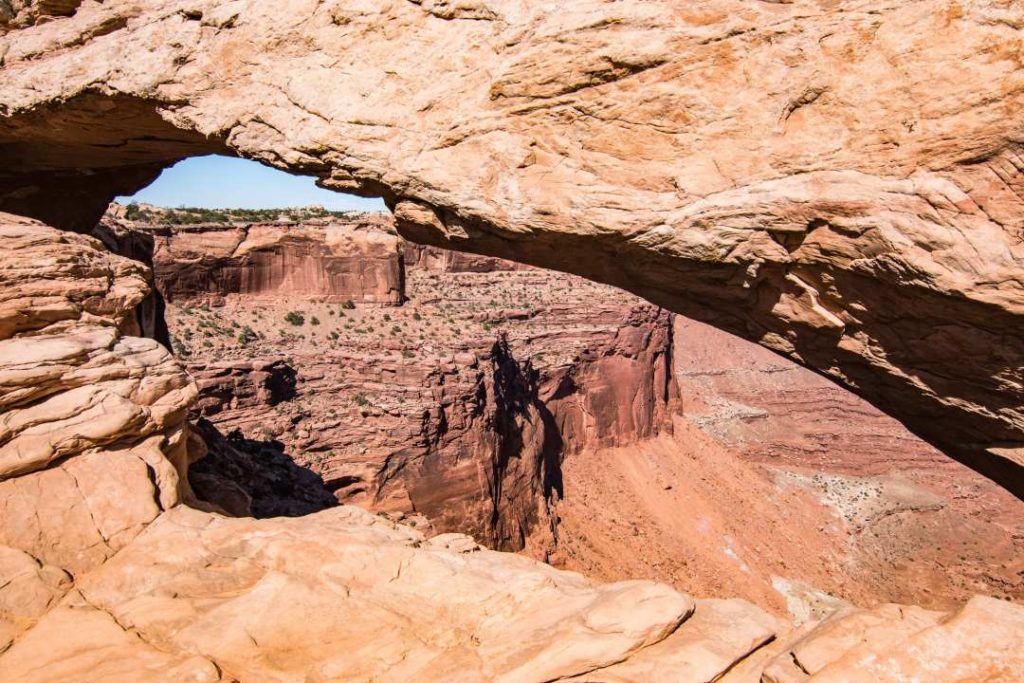
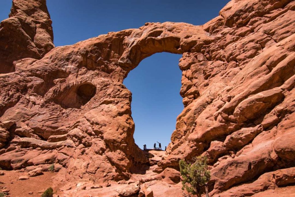
Mesa Arch
Second stop, Mesa Arch. Very popular place especially at sunrise. It is one of the most photographed places. It is an arch in the side of a cliff.
- Distance: 0.8 km round trip
- Time: 30 minutes
- Level: easy
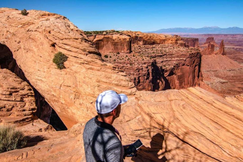
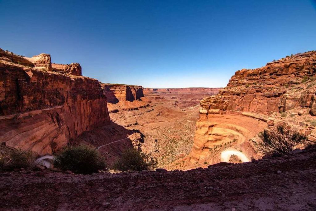
Shafer Canyon
Driving down to the bottom of this canyon will give you some thrills, like it did for me! Phewwww! Don’t look down too much!
The road is wide enough for one car only on the serpentine road. In a few places, such as curves, it is easier to let a car pass in the opposite direction. So you have to check in advance if you see a car coming down the road to let it pass at the right place.
- The road down is just to the left of the park entrance, before the Visitor Center.
- You must have a 4×4 vehicle.
It’s all downhill from here! I had a hard time finding a good place to take a picture of the path.
Murphy Point
End of the afternoon at Canyonlands, we went to finish this beautiful day with a nice walk at Murphy Point. In this huge park that is Canyonlands, Murphy Point is located in the Island in the Sky part.
- 6.4 km round trip
- Height difference: 50 meters
- Time: 2 hours
- Cost: US$30/vehicle valid for 7 days. American Pass accepted.
You will start the trail in meadows and sand, which slowly turns into a more rocky trail. The further along the trail we go, the more we start to get a view of the surrounding canyons. Since the sun is setting, it leaves a really nice light on the rock faces.
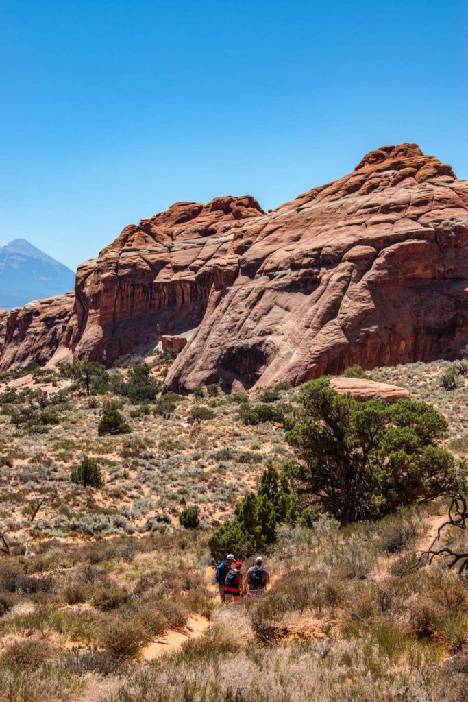
Arches National Park
With a concentration of over 2000 arches, Arches National Park has enough to keep you busy for days! Just driving through the park is a show in itself.
We spent about a day and a half there. But there is so much to see that you could easily spend a few days. There will be something for everyone, short or long hikes.
- Official website: Arches National Park
- Cost: $30USD/vehicle, valid for 7 days
- American Pass accepted
- Map to download : arches-map
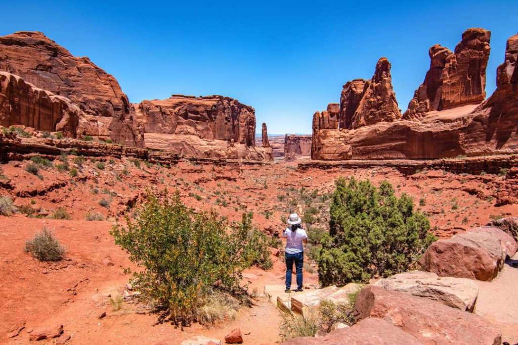
Park Avenue view point
This is one of the first places you will come across on your way. I only made a short stop there since we had just finished a big hike. It was very hot, the walk was enough for the day.
- Park Avenue Trail: Easy trail, 3.2 km. About 1h30 round trip
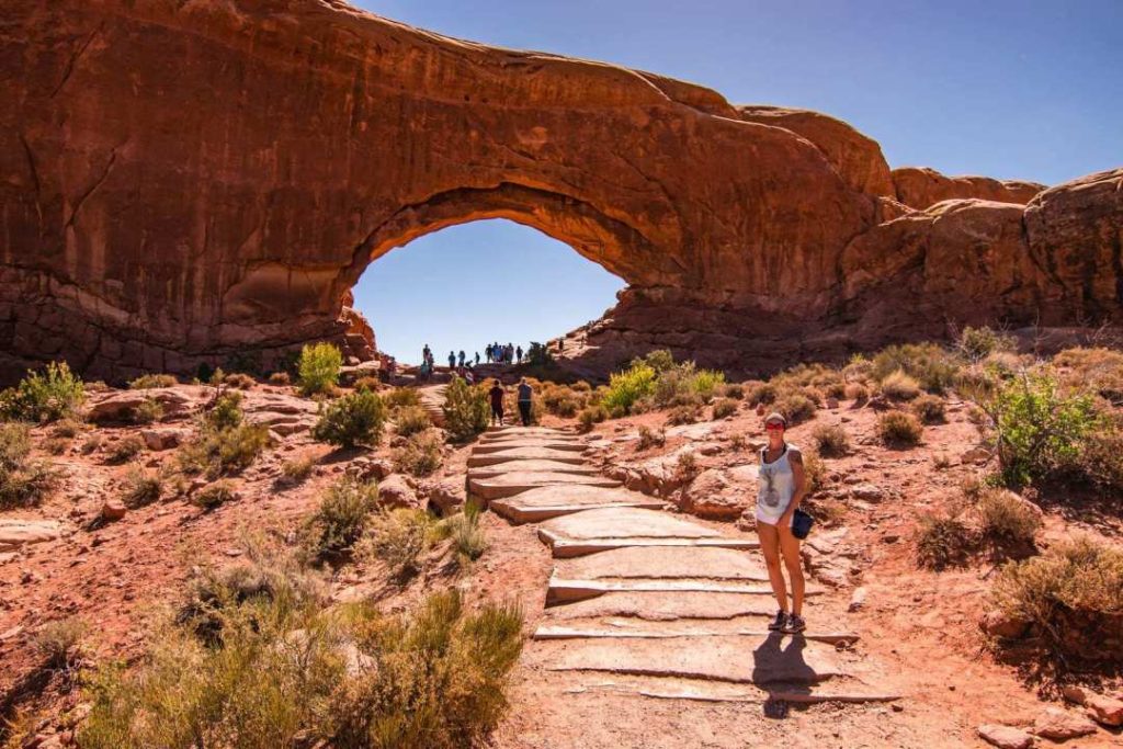
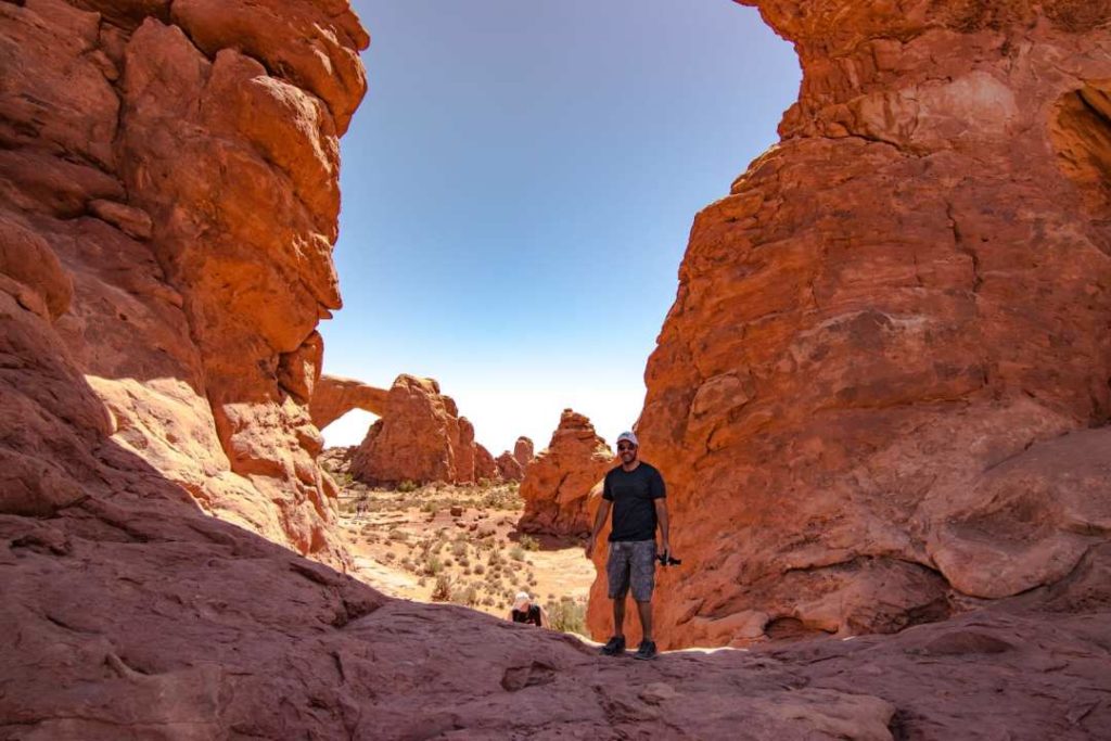
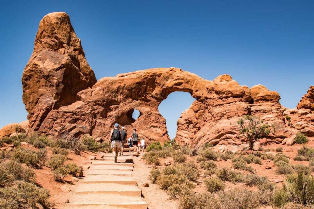
The Windows and Turret Arch
Two imposing arches, it would be a shame to pass by without walking close by. You can walk to Turret Arch which is next to it.
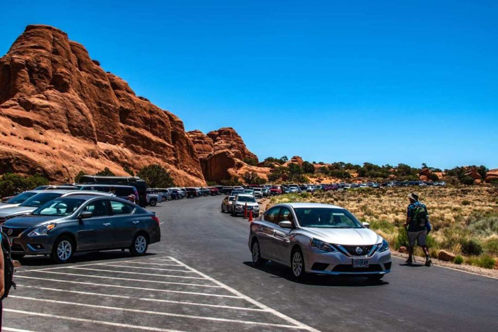
If you go in the afternoon like us, it will be more difficult to find parking. You may have to wait for someone to leave to take their spot. Do not park in prohibited areas! An officer goes around giving out tickets.
The Windows
- Time: 1 hour
- Level: Easy
- Distance: Loop of about 1.6 km
Turret Arch
You can walk inside this arch too, it’s pretty impressive.
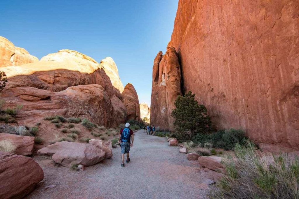
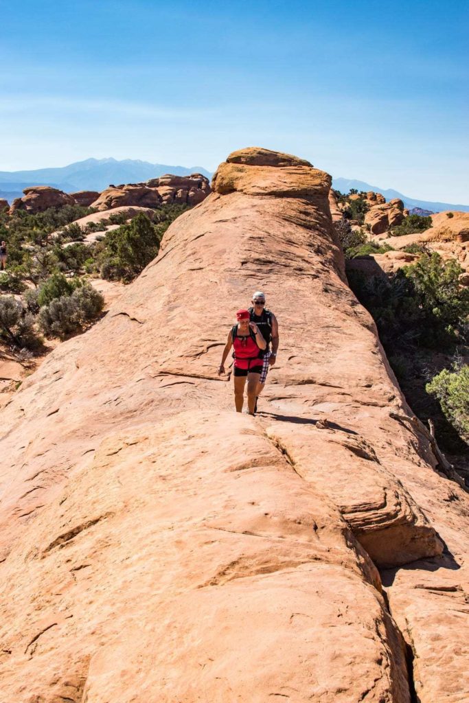
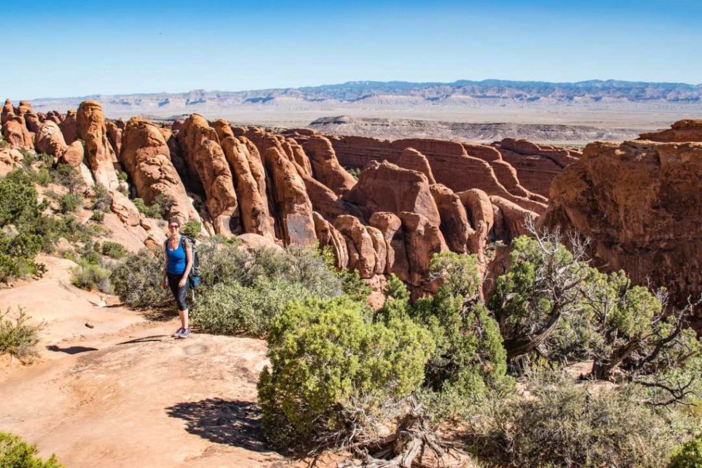
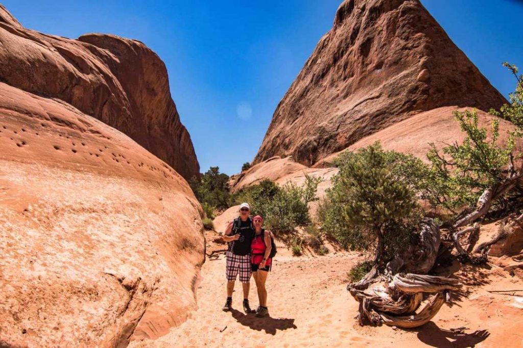
Devil's Garden & Primitive Trail
People claim it’s the most beautiful trail in the park, and I support this statement 100%! Do it early in the morning, bring plenty of water and recharge your camera.
Devil’s Garden is at the very end of the park. You will have to cross the entire Scenic Drive in the park. Lesser evil, because this road is a real treat.
- Cost: $30 US/vehicle, valid for 7 days.
- American Pass accepted.
- Driving time from the Visitor Center: 30-40 minutes
- Official website for additional information and to check for alerts: Arches National Park NPS
Arriving early is the key! You’ll avoid the afternoon heat and find parking much easier! This is what the parking lot looked like in the late morning. People wait for cars to leave to take their spot.
Which trail option should you choose?
You have two options. Do a round trip to Double O Arch or continue and do a full loop combining Primitive Trail.
- Round trip distance for Double O Arch: 3.7 km
- Entire loop: 11.5 km
- Complete loop time: 4h with breaks
- Elevation gain: Some technical and steep sections, but otherwise nothing very important.
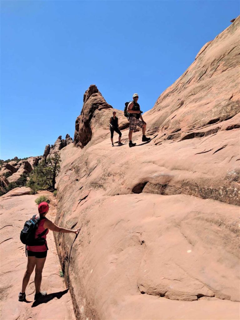
The entire loop, Primitive Trail, is considered difficult. It’s not as hard as I thought it would be. A portion of the trail is more technical. I will describe this section below with pictures.
People turn back at Double O Arch, so you won’t see many people on the Primitive Trail.
Note: we did not go to Partition Arch, Navajo Arch, Dark Angel Arch and Private Arch. It was already very hot in the morning and we wanted to be sure to complete the loop, my parents having less experience of long hikes in the heat.
We start the trail by passing by Tunnel Arch. Huge rock faces await us and leave us expecting that the trail will be of great beauty!
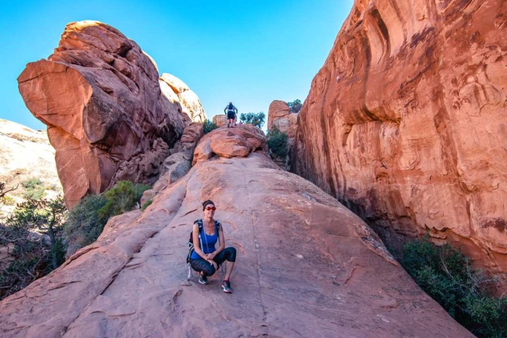
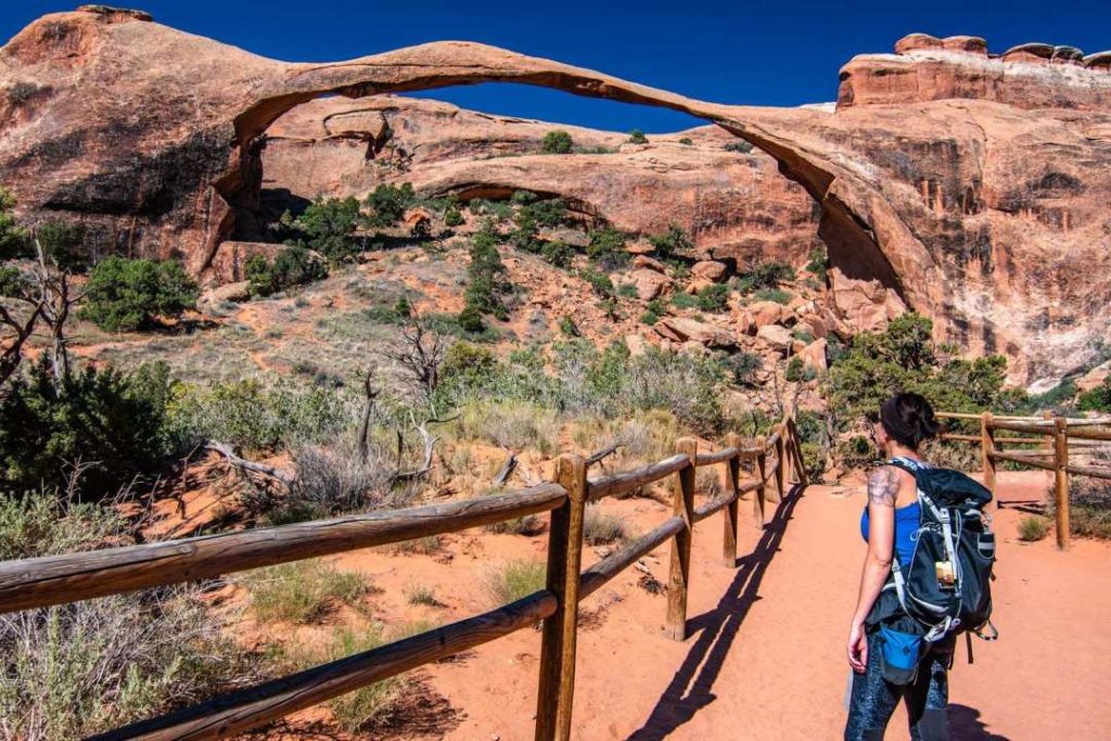
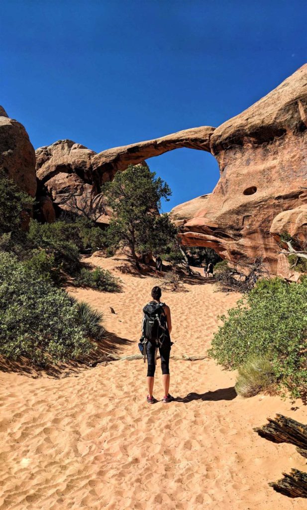
On your way, you will pass Landscape Arch, the largest natural arch in the world! It is 90 meters long. You don’t need to take the short detour to see it.
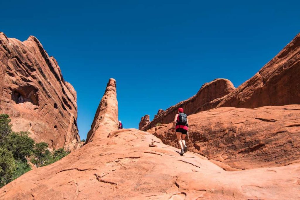
The first, more technical, steep section will not last very long.
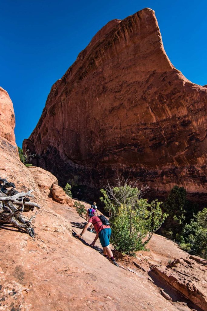
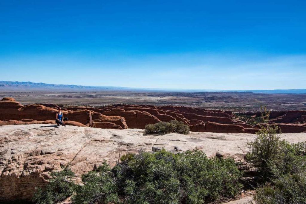
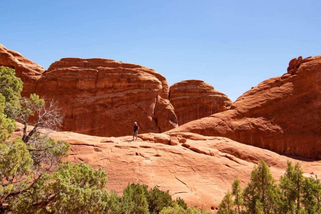
After this little moment of climbing, you will walk on a ridge. Get ready for a sublime visual on Devil’s Garden!

A little further on you will come to Double O Arch. This is where most people turn back. The heat and length of the trail are not suitable for everyone.

Primitive Trail
From here, you make the choice to continue or not. Your level of fitness and your tolerance to heat will help you decide at this time. But it would be really sad to miss this part of the trail!
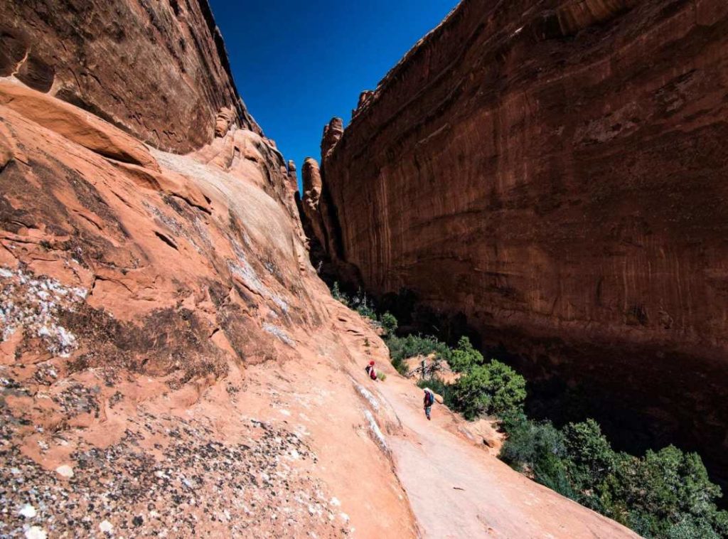
The Primitive Trail is less well marked than the first portion. Be careful to spot the small piles of rocks that mark the trail. We passed some people chatting and they got lost. They found their way back, but stay alert!

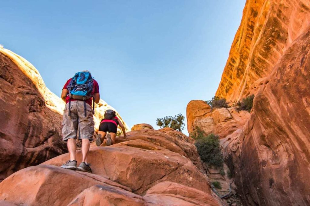
You will arrive at the part which is more technical. You have to climb a rather steep rock. I was a bit dizzy, but with help, it went well! I slid down a few bits on my buttocks.
After this technical portion, it’s not over yet! Nope! More beautiful landscapes!
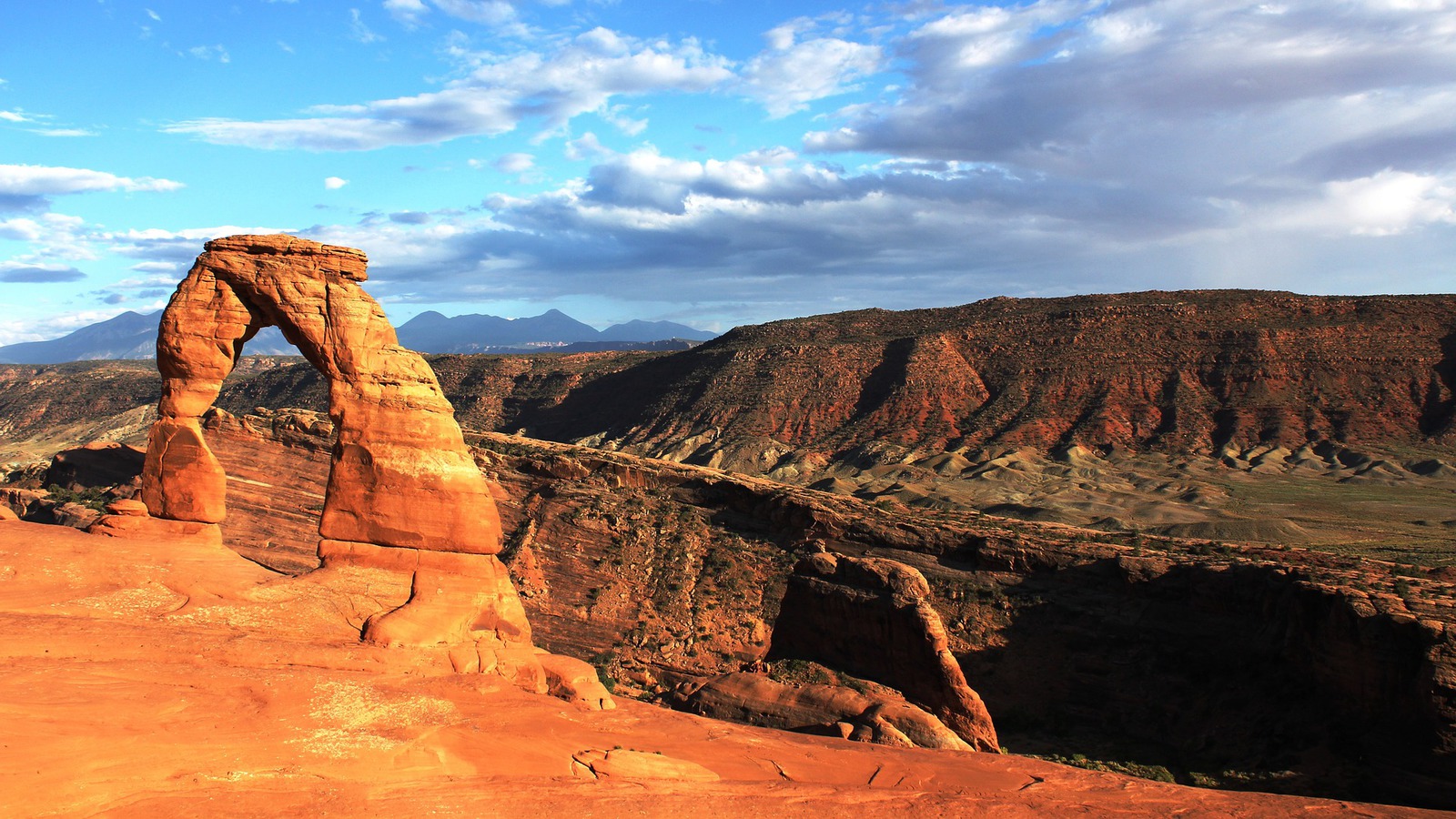
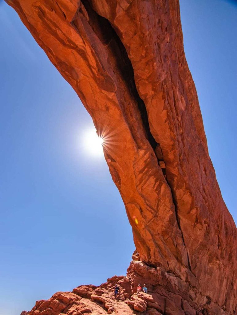
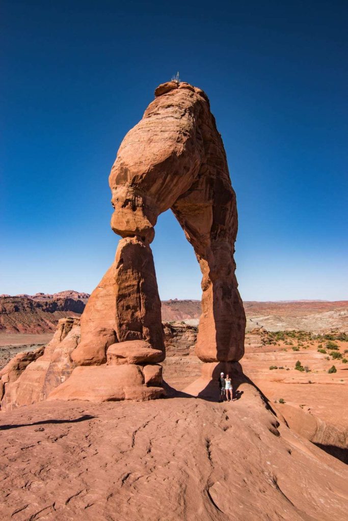
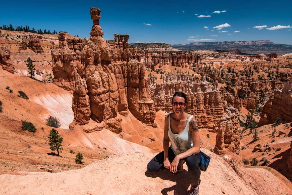
Delicate Arch, the emblem of Utah
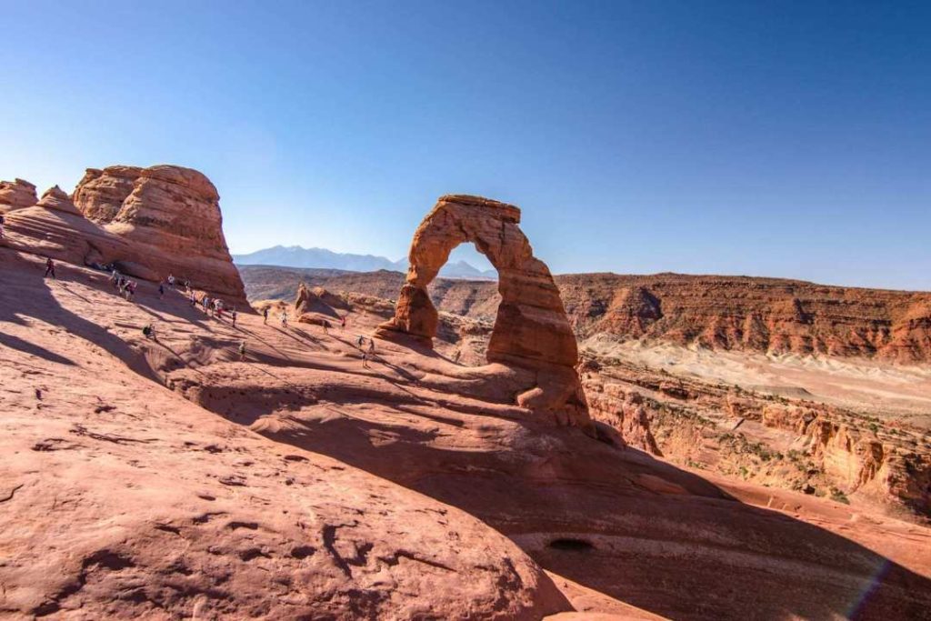
Emblematic of Utah, Delicate Arch is a 20 meter natural arch and is probably the most beautiful in the park!
To see this beauty, you’ll have to put in a little effort. I advise you to go early to avoid the heat and once again, find a parking space.
- Round trip distance: 4.8 km
- Difficulty: intermediate
- Time: 2h30
- Official website: Delicate Arch – NPS
- Cost: $30 US/vehicle valid for 7 days. American Pass accepted
Accommodation in Moab
No kidding, you have to book in advance, especially in high season. More than 6 months if possible. If not, you will pay a lot more. All cheap accommodation will be taken. Unless you can get your hands on some last minute cancellations!
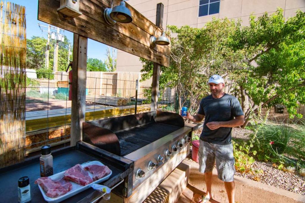
I found a real gem on Booking! A basement in a house, washer and dryer, outdoor BBQ, small kitchen. It was really perfect!
The best part is that you are on the main street in Moab and only 10 minutes from Arches National Park.
- Cost: $480 USD for 3 nights ($622 CAD)
- Name: StellaRuby Cottage


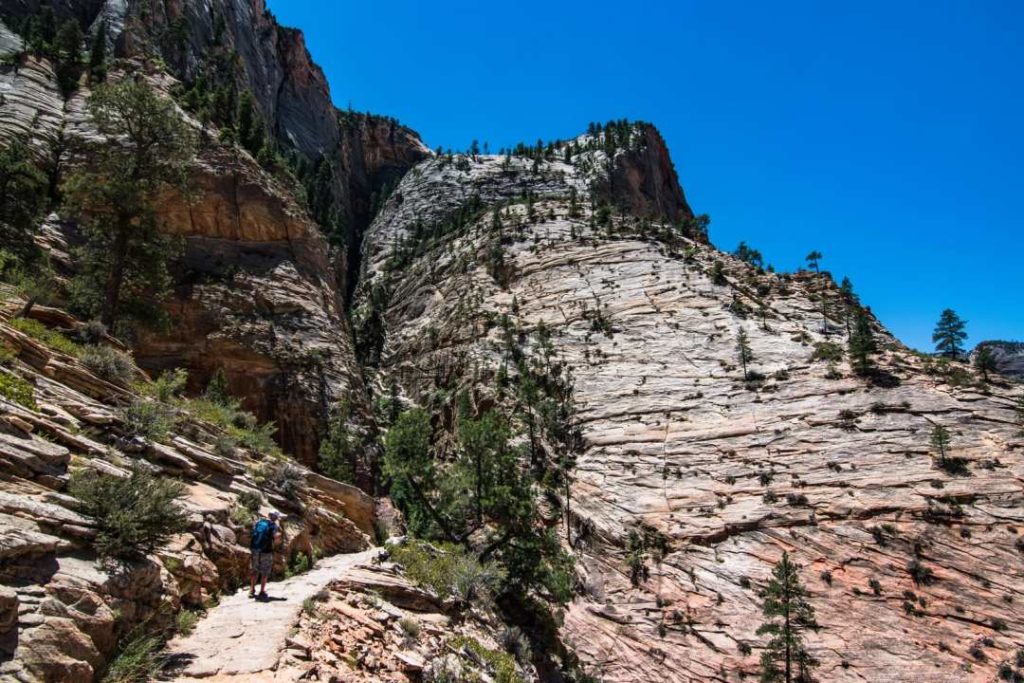
Day 9 and 10 - Zion National Park
- Itinerary day 9: Moab – Goblin Valley – Capitol Reef – Zion
- Itinerary day 10: Day in Zion National Park
- Time to complete route: 6h20, 547 km
- Time Moab – Goblin Valley : 1h40
- Time Goblin Valley – Capitol Reef : 1h
- Time Capitol Reef – Zion : 3h15
I would like to point out a mistake I made. In my mind, Zion was further north than Bryce Canyon. I realized my mistake two months before we left. I did some research to see if there were any free accommodations so I could change my itinerary. Nothing was available near the parks at an affordable price. Fortunately, Bryce is a 2 hour drive from Zion. So it wasn’t too serious to retrace our steps.
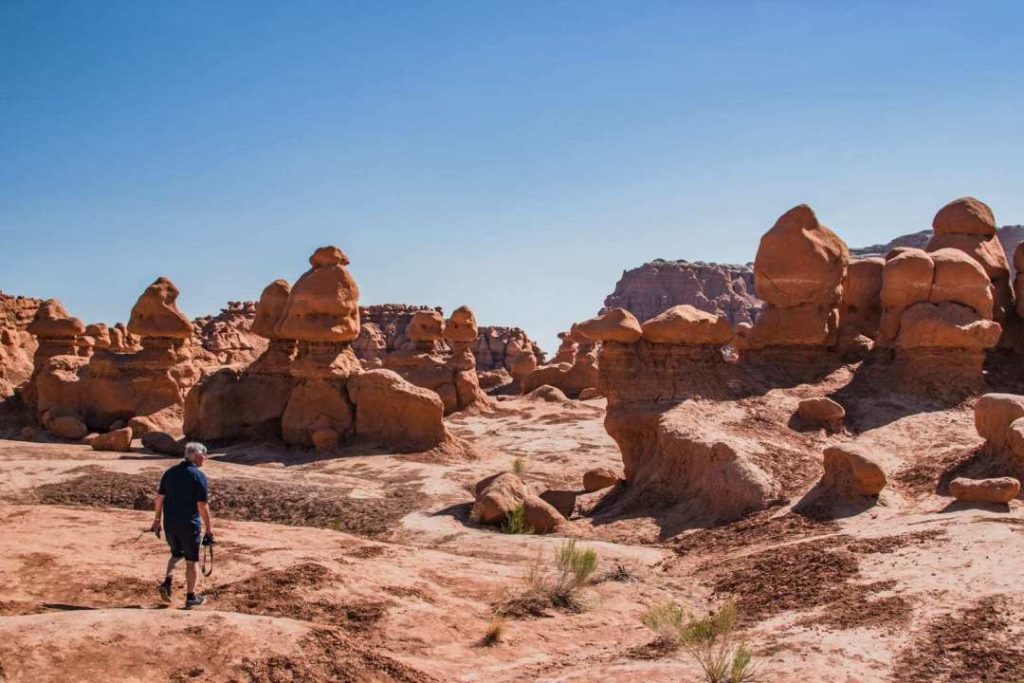
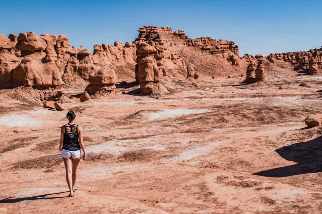
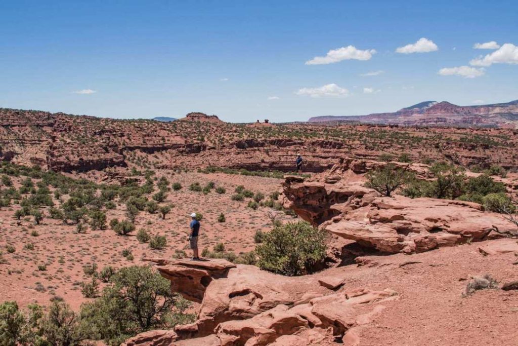
Goblin Valley State Park
Rock formations that can look like little men or something else depending on your imagination… Goblin Valley is worth a little detour!
The rocks shapes are the result of the erosion of ancient mountains dating back 170 million years, which createf these small sculptures in the shape of little men.
- Official website Goblin Valley State Park
- It’s a State Park, which means that American Pass is not accepted.
- Entrance fee: $15 USD per vehicle
- Open all year round from 6am to 10pm
- Star reserve
- 1h40 from Moab
- Time: Between Capitol Reef and Moab, it takes only 20 minutes from UT24 to get there.
- A few short hikes are possible, see roadtrippin.ca for details.


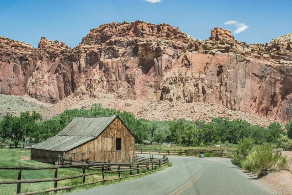
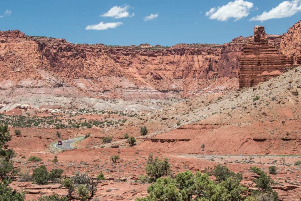
Capitol Reef and Scenic Drive 12
Scenic Drive 12 is a 200 km long road between Bryce Canyon and Capitol Reef and deserves our full attention. I hadn’t really planned to stop on this road. But Oh! What a road!
Check out this website to help you plan your route: Scenic drive – roadtrippin


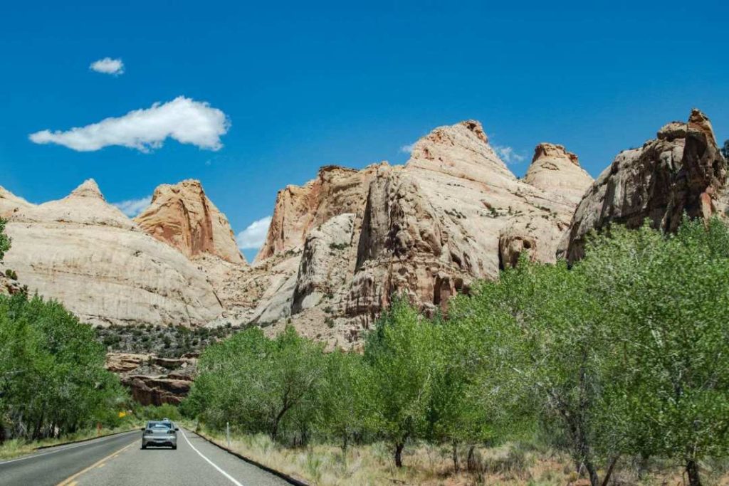
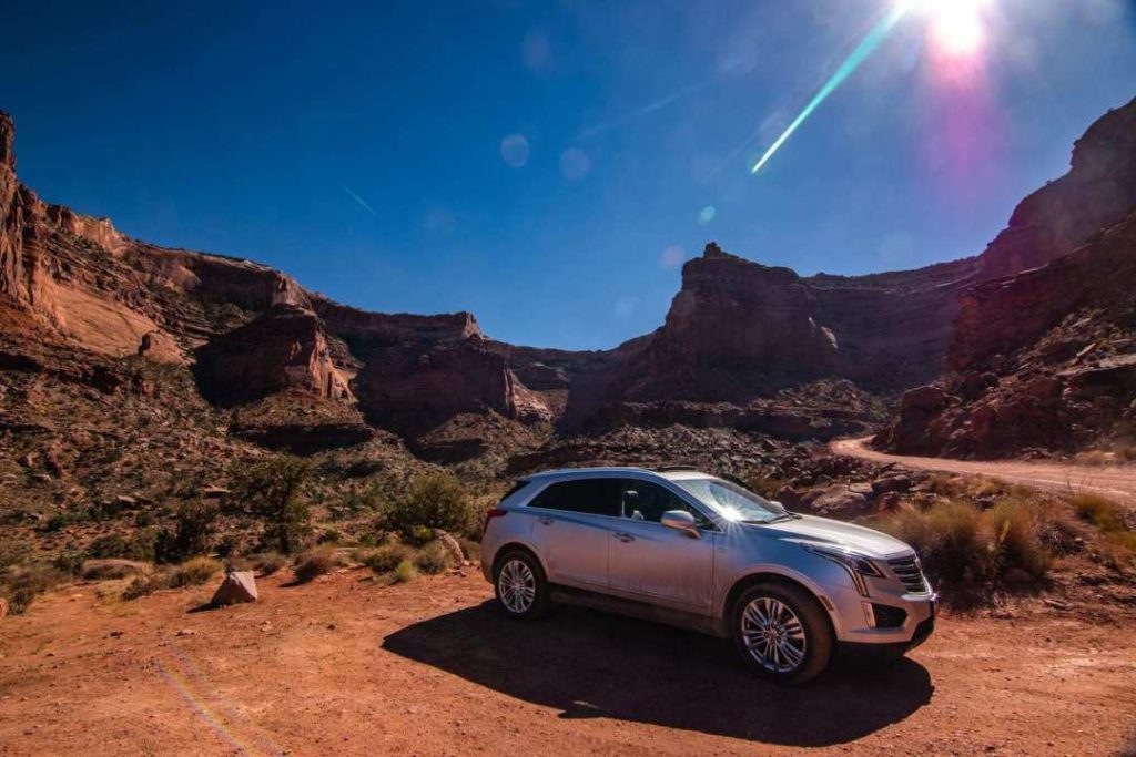
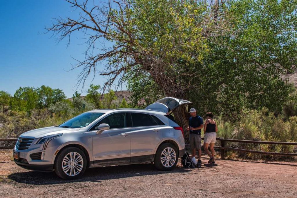
On this road, we stopped for lunch and found a small wild spot in the shade of a tree. All our lunches were enjoyed in the back of our beautiful Cadillac SUV rental. I loved this vehicle for this kind of trip.
After lunch, we continued on the road and passed Capitol Reef. We HAD TO make a stop there even if it was not planned!
- Entrance fee: $15 USD/vehicle, valid for 7 days
- American Pass accepted
- Official website: Capitol Reef NPS
My only small regret is not having planned time in Fruita! Fruit tree orchards with the red rocks in the background. Wonderful! From June to October, it is possible to pick your own fruit with a voluntary contribution. Apparently, the peaches are excellent! Very easy to reach from UT24.
We then headed to the Capitol Reef Visitor Center to ask if there is a short hike of less than an hour. Panorama Point is what was suggested to me. This little trail is not to be overlooked if you are passing by and you are short of time. You will have an incredible view of the area. Just enough to leave you wanting more!
- Level: very easy
- Time: 30 minutes
- Distance: 320 meters round trip
Zion national park
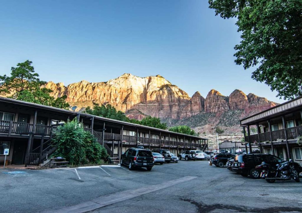
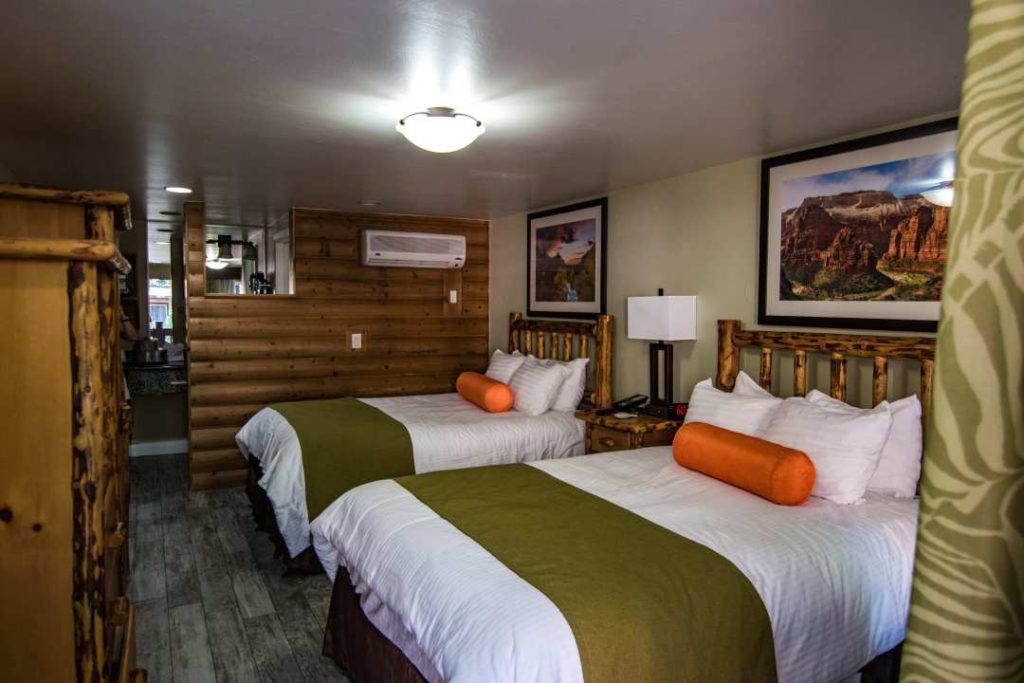
With 4.5 million visitors per year, Zion is a very busy place! By booking early, I had found a hotel in the village of Zion. This small village with the rocky scenery in the background will charm you. There are good restaurants, art galleries and shops. Pioneer Lodge is located close to the park and within walking distance of restaurants and shops. Very comfortable and clean room.
- Price: $494, 2 nights/4 people
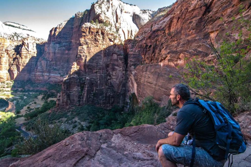
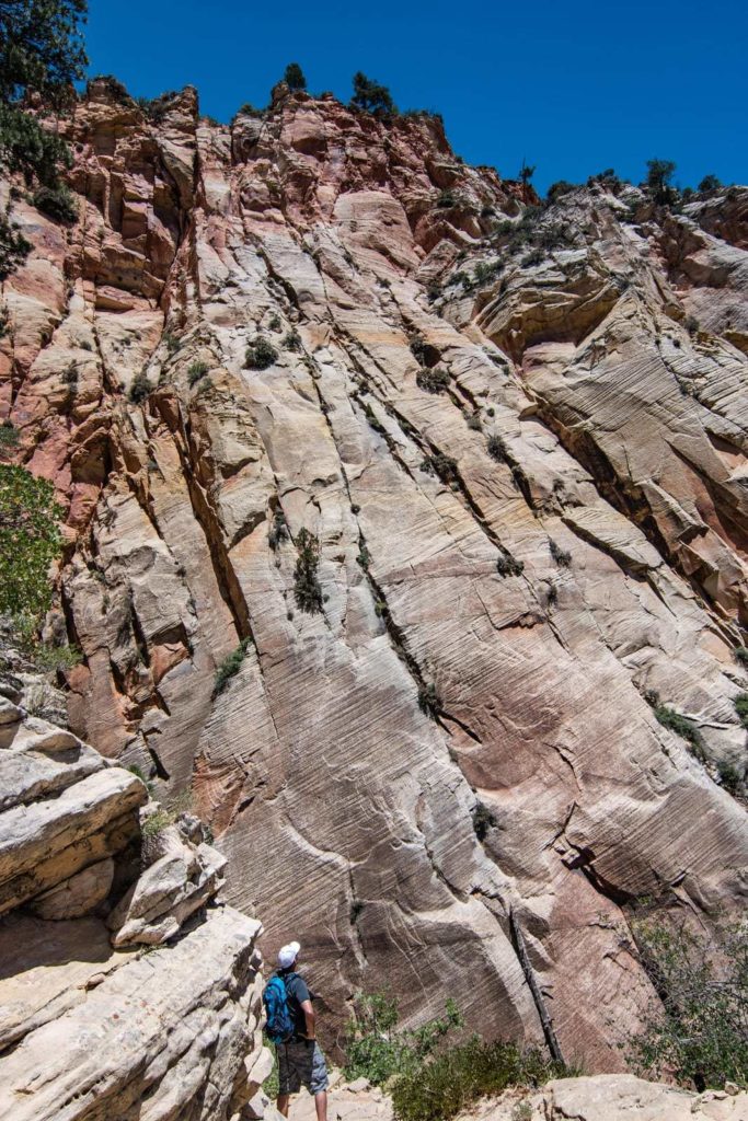
For this second visit to Zion National Park, I was really looking forward to seeing the magnificent view that Observation Point offers at the end!
On my first visit in 2011, like most people, I went on THE most popular hike in the park: Angel’s Landing
Yes, Angel’s Landing has a great view, but to access that view, we must take risks. A simple chain on a relatively steep wall will probably give you a few cold sweats! A few deaths occurred there… So I didn’t do that part and I didn’t see the other side of that steep wall. You absolutely must go to this side for the final view. For those who are afraid of heights like me, Observation Point is perfect for you!
It is very important to consult the official park website before a visit. You will see weather alerts or closed trails. Especially in July and August, there is a greater risk of Flash Floods. These are large torrential rains that can turn into a river. This is very dangerous.
- Distance: 13 km round trip
- Time: 4h30
- Elevation gain: about 650 meters
- Official website Zion National Park
- Cost: $35USD per vehicle valid for 7 days
- American Pass accepted
- Time: Southwestern Utah, 2.5 hours drive from Las Vegas
Parking and travel in the park
With 4.5 million visitors a year, it’s not surprising that a shuttle system was introduced! From mid-March to mid-November you will need to leave your vehicle at the entrance to the Zion Canyon area.
There are two shuttle lines:
- Sprindale Shuttle: 9 stops between Majestic View in Springdale and Zion Visitor Center.
- Zion Canyon Shuttle: 9 stops at Zion Visitor Center and Temple of Sinawava. It takes about 45 minutes to reach the latter point.
Here is the map of the shuttle in the city of Springdale and the one directly in the park: Map Shuttle Zion
There are shuttle buses every 15 minutes. There is a big “but” though…
We arrive at the Visitor Center early, around 7:00 am to take one of the first shuttles. It’s going to be 110 degrees Fahrenheit and I don’t feel like hiking in the hot sun.
There’s the big “but”…
We weren’t the only ones who had the same idea! Many people are already waiting in line. A very long queue. So long that we managed to board a shuttle at 8:45 am! It takes a good 25 minutes to get to stop number 7. So we started the climb at about 9:15am.
A little tip to save time, walk to stop number 2 if you feel like it. They don’t fill up the shuttles at stop number 1 so they can pick up people at the other stops.
For this hike my parents did not come with us. They went to do the Watchman Trail which starts at the Visitor Center. They didn’t have to wait for the shuttle. Lucky them! Very nice hike by the way for those who want to do an easier hike.
I was a little afraid that we had started our hike too late because of the wait for the shuttle. I was afraid that it was already too hot and that I would be too exposed to the heat. You’ll see in the first photo that at this time of day, much of the trail is not exposed to the sun. Which is the opposite in the afternoon!
After about 2 km you will come to a section called Echo Canyon Passage. These pictures were taken on the way back, because the light was more beautiful. That’s pretty impressive!
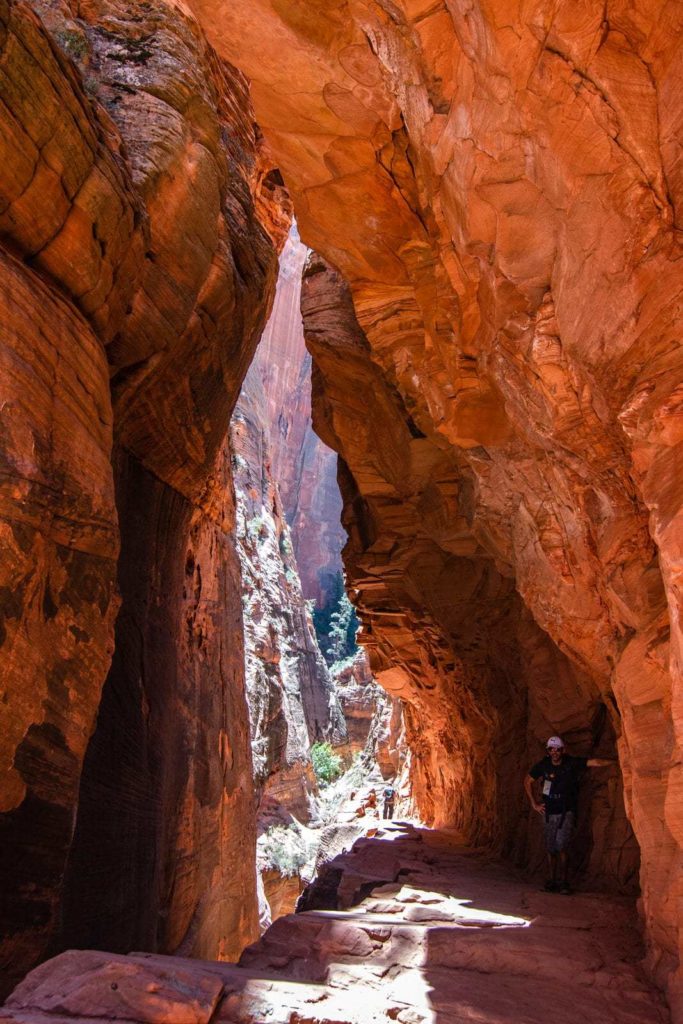
After this passage, it starts to clear and you climb up the cliff side and the scenery changes completely.

After hiking a little more than halfway up the trail, you will reach higher ground and begin to get a view of Zion Canyon. You will finally reach your ultimate goal with the view of Zion Canyon! In the background you can see the winding road. The last part of the trail is on a plateau.
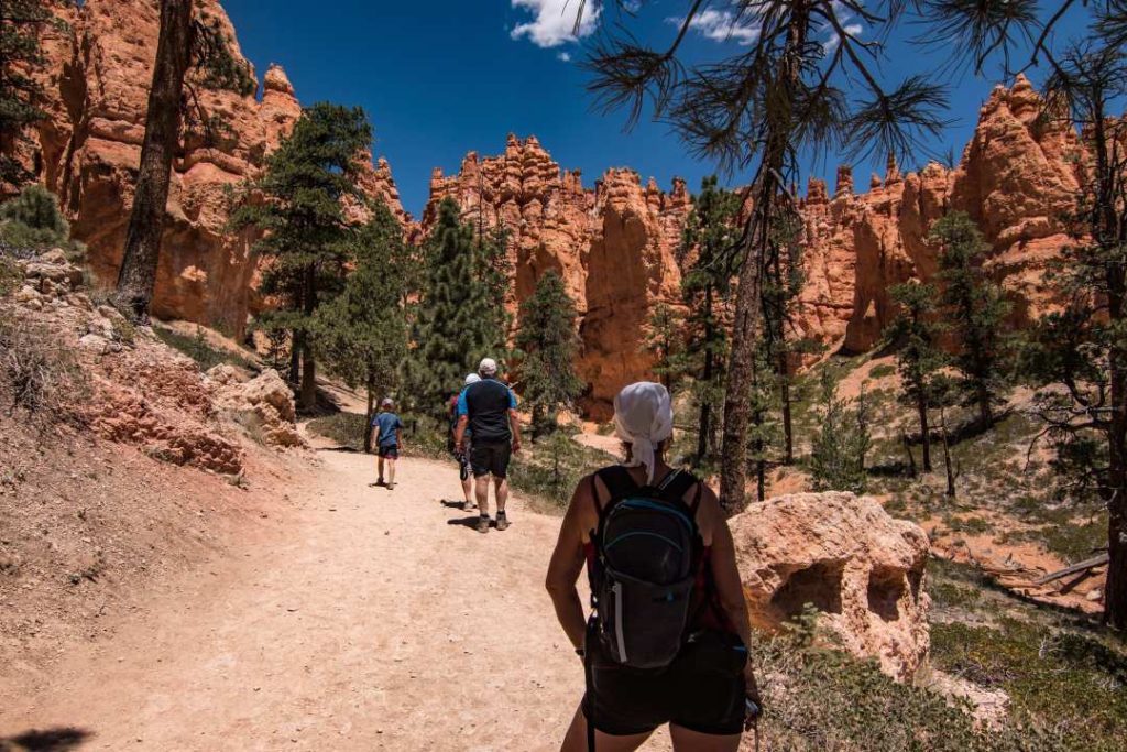
Day 11 - Bryce Canyon
- Itinerary: Zion – Bryce
- Time Zion to Bryce: 2h
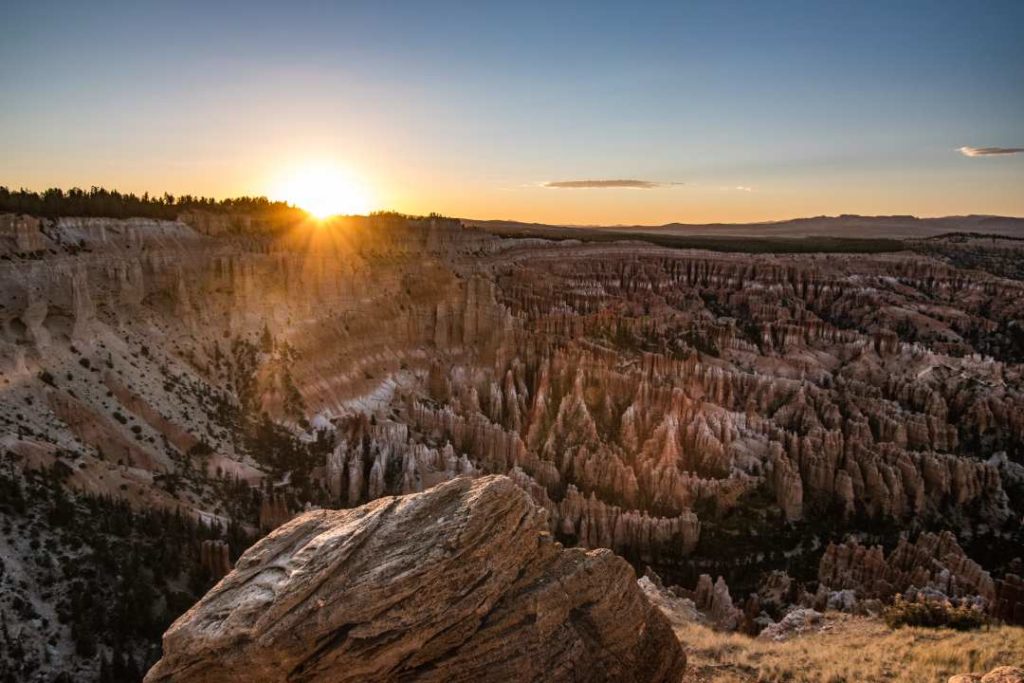
The climax! There are no words to describe this place. You have to be there. Going to Utah and not going to Bryce Canyon is like going to Paris and not seeing the Eiffel Tower (in my opinion)!
The first time I visited Bryce Canyon, I was overwhelmed. Was this place real? I think this is the part of the trip I was most looking forward to showing my parents. I was right, it was the most memorable moment!
Bryce Canyon Park Information
- Only 4 hours drive from Las Vegas!
- Official website
- Always check the official website for alerts. Closed roads or trails for example.
- Cost: $35USD vehicle valid for 7 days
- American Pass accepted
- You can visit the park by shuttle. This is a good option if there are many visitors. Finding parking at every stop can be difficult. See details here
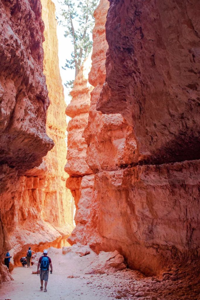
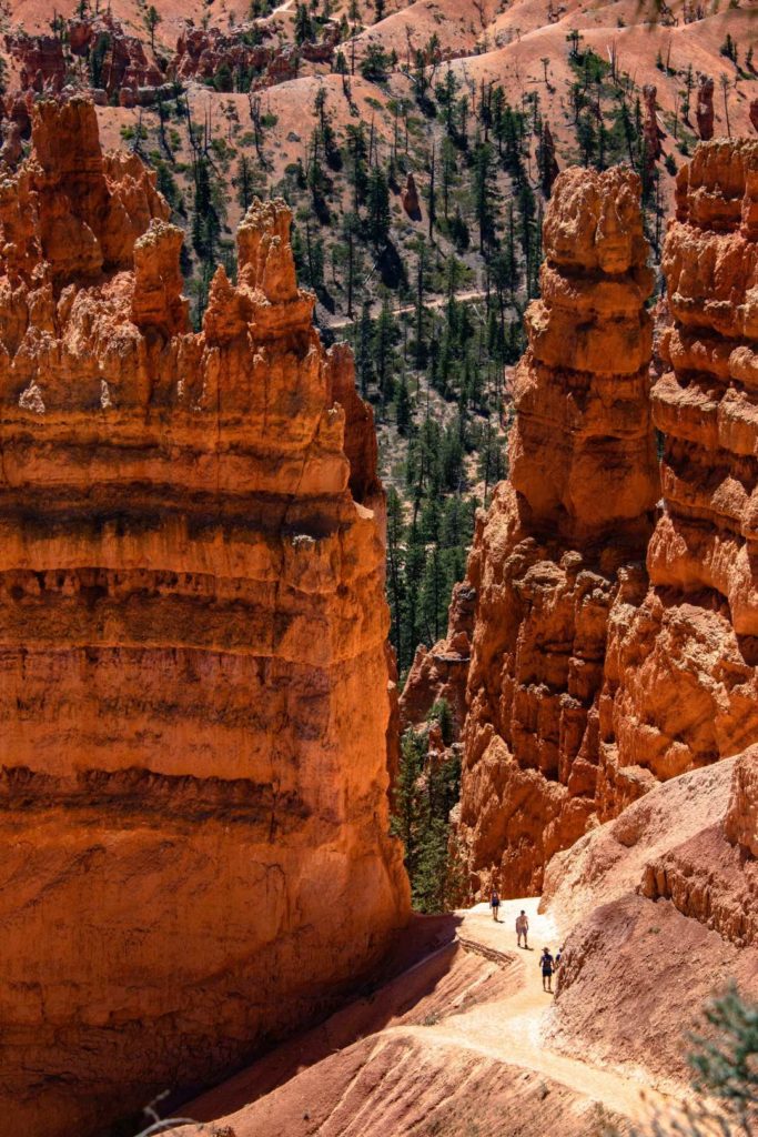
We did the most popular trail, the Navajo Loop. It’s busy, but it’s a nice alternative when you don’t have much time.
Navajo Loop
- Departure at Sunset Point
- Time: 1-2 hours depending on your pace
- 2.2 km loop
- Possibility to combine Queen’s Bath for a total of 4.6 km. However, you will finish the trail at Sunrise Point. If your vehicle is parked at Sunset Point, you must add 1.6 km from Sunrise Point. This portion is easy.
We did the trail clockwise. You will start with a descent through the hoodoos. It’s so impressive that your head will move up and down constantly!
HOODOOS: The fairy chimney is a natural column made of friable rocks and whose top rock is more resistant to erosion.
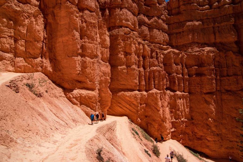
Then you will walk a relatively flat trail through the beautiful orange rocks and conifers.
Every little bit of shade is important! Drink water and rest as often as necessary. It is very hot at lunchtime!
When you start to go back up, what a fantastic setting! This is probably the most beautiful place I have ever seen in my life! I hope to be able to walk there at least one more time, but in winter with a nice white carpet through the hoodoos.
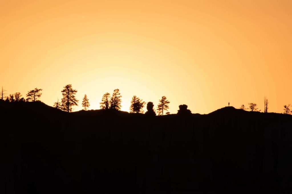
Sunset at Bryce Canyon
Our accommodation was about 15 minutes away. So we went back in the evening to see the sunset. The employee at the entrance strongly suggests that we go and observe it at Inspiration Point. From the parking lot it’s about a 5 minute walk.
There are a lot of people but that doesn’t take away from the show.
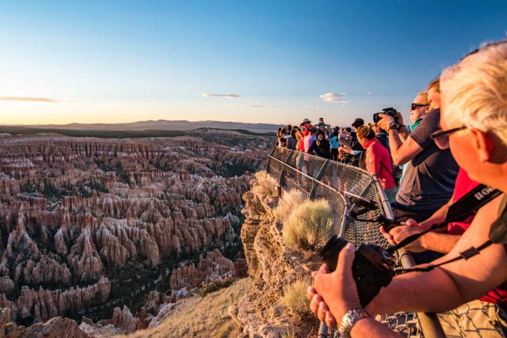
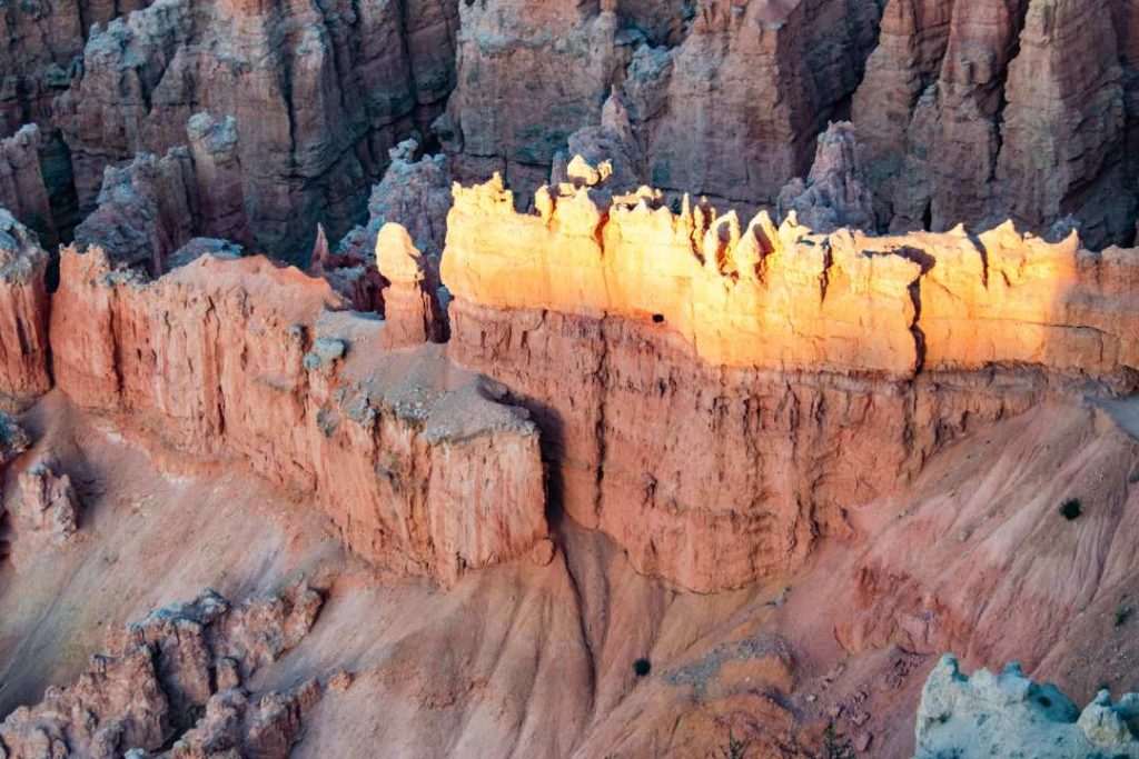
Take a good look at the following picture. I zoomed in with my 28-300mm lens on the rock wall on the other side. On the right side of the picture, I found someone! I especially love this picture.
Accommodation
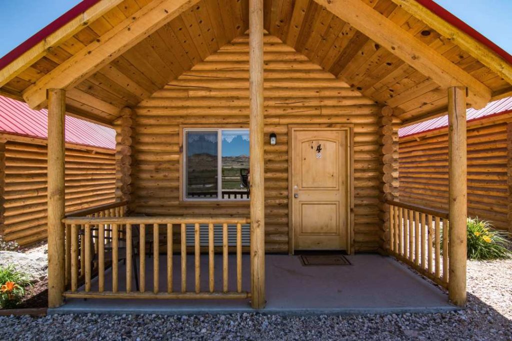
Located about 15 minutes from the park, Bryce Canyon Lodge Cabin in Tropic is a beautiful place to stay overnight.
The cabins are very clean and comfortable. You will be located directly next to a field with sheep.
- In June, we paid $149USD per night for 4 people.
- Restaurants within walking distance.
- Laundry room in the hotel across the street. Ask at the reception.
Days 12-13-14 - Las Vegas Area
Here is the itinerary for the last 3 days:
- Itinerary day 12: Bryce Canyon – Valley of Fire – Las Vegas
- Time Bryce Canyon – Valley of Fire: 4 hrs. Then add 1 hour to Las Vegas.
- Itinerary day 13: Las Vegas – Hoover Dam – Lake Mead
- Time Las Vegas – Hoover Dam: 45 minutes. It takes 15 minutes from Hoover Dam to get to Lake Mead.
- Itinerary day 14: Las Vegas – Montreal: the end?
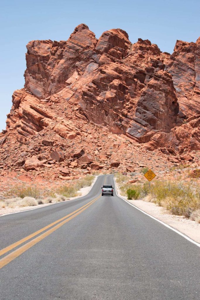
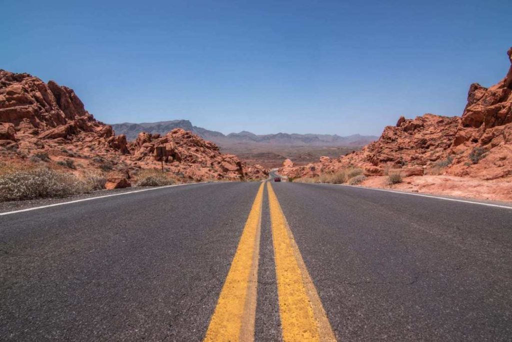
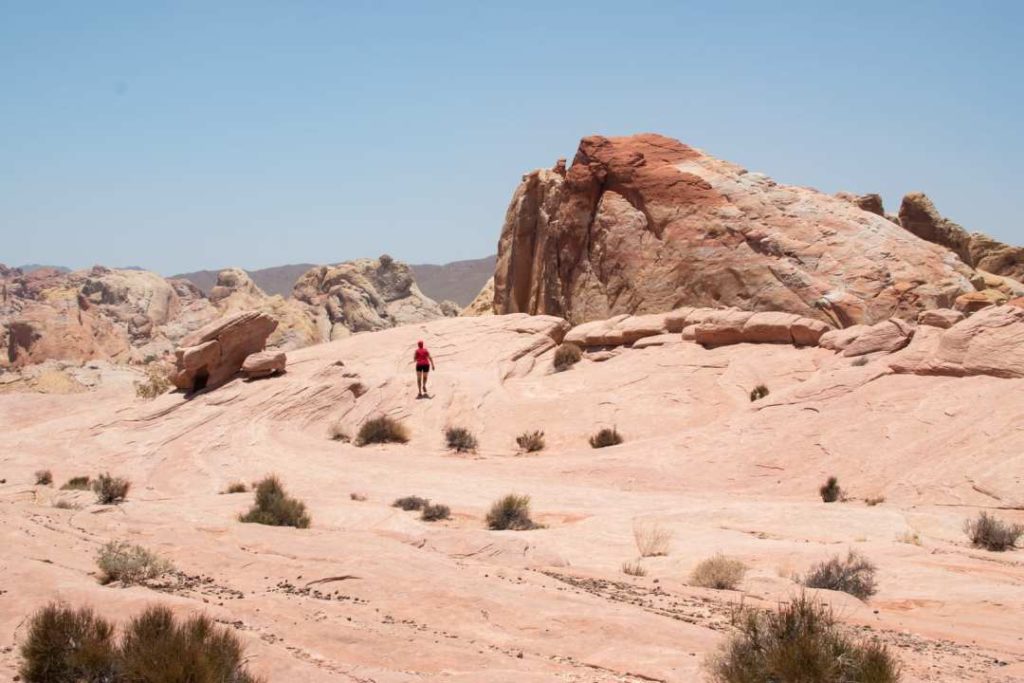
Valley of Fire
This park can proudly bear its name! You have to be really heat tolerant to go walking in there. It must have been between 45 and 50 degrees Celsius! I really wish I could have gone for a walk, it’s a spectacular place. I’ll have to come back in the colder season. Be careful not to catch fire on the spot.
- Official website: Valley of Fire State Park
- Entrance fee: 10 USD
- American Pass is not accepted
- Time : 1 hour from Las Vegas and 2h30 from Zion National Park
- Best month to go: October to April
- The Fire Wave trail seems to be THE trail to do. Unfortunately, we did not venture out because of the heat.

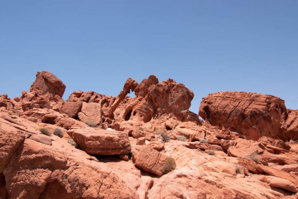
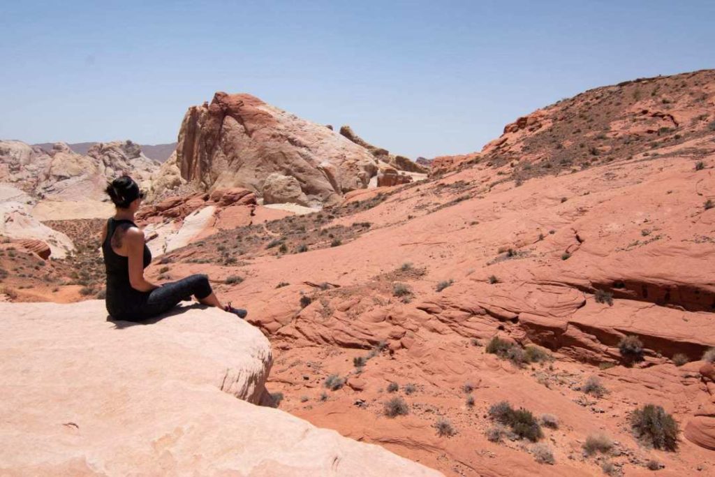
Elephant Rock
At the east entrance of the park, from the first parking lot on your right, you will have access to the short trail. It’s really short. You can see a rock formation with an elephant silhouette.
- Difficulty: Very easy
- Distance: 0.6 km round trip
Then we drove around the park. Me and my mom went out to take some pictures. The men did not want to leave the air conditioning!
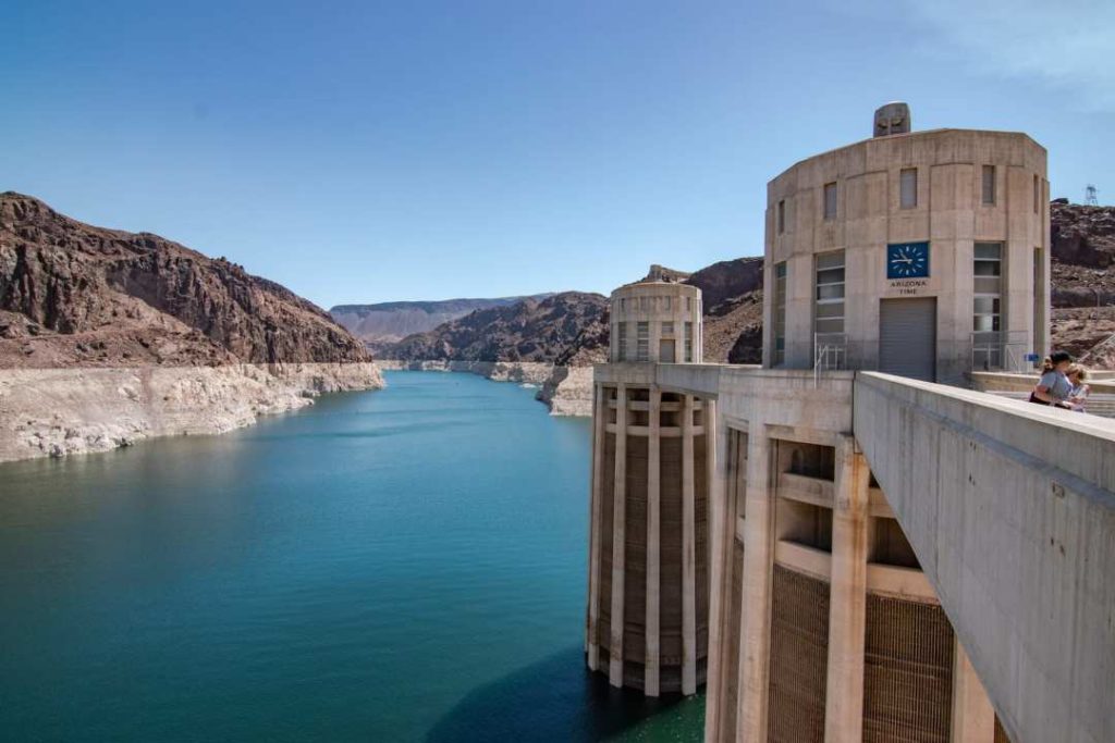
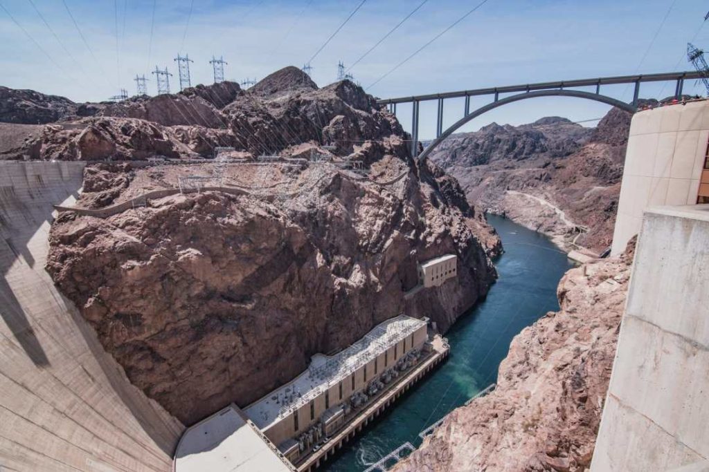
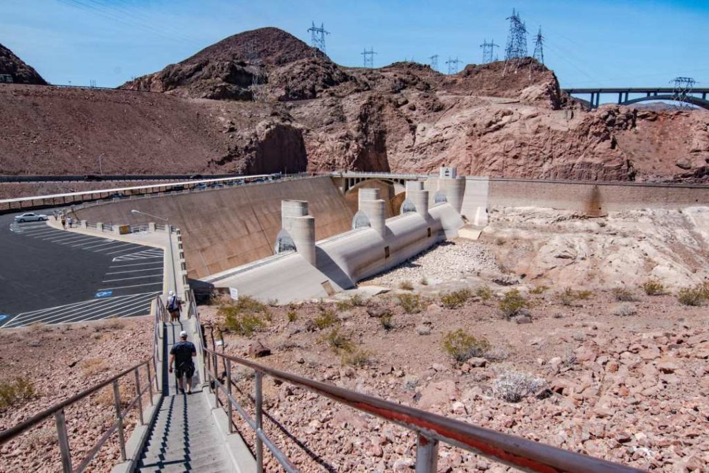
Hoover Dam
Our last two days were in Las Vegas. What could we do during the day? Visiting the City for me in the evening is enough. In any case, it is much too hot! Then I remembered that the Hoover Dam is not so far away.
This dam was built in 1931 over a period of 5 years. Its archweight shape was built on the Colorado River and required 7 million tons of concrete. 112 workers died there.
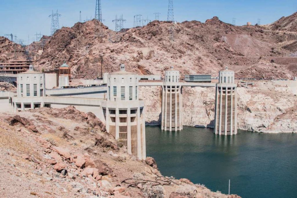
It’s a pretty impressive place. I drove by it about 10 years ago, but I didn’t stop there.
- Official Hoover Dam website if you want to visit the facilities
- Parking
- Fee: it is located near the Visitor Center. 10 USD.
- Free of charge: There are several parking areas at different heights along the road. You will have to walk to see the outdoor facilities. You must think that it is very hot and that you will have to walk back up.
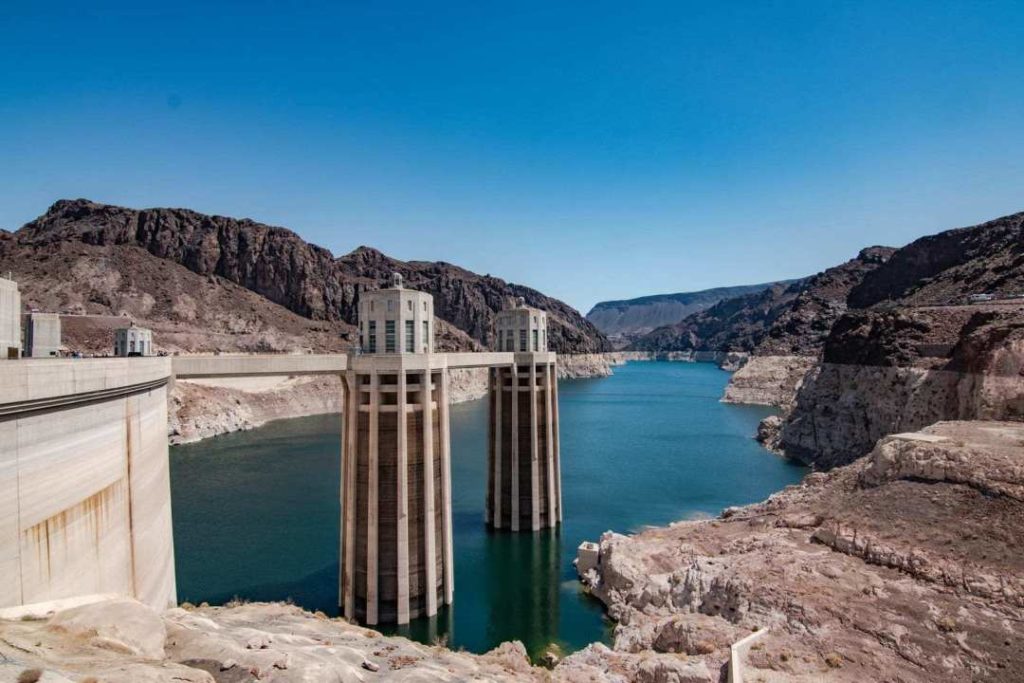
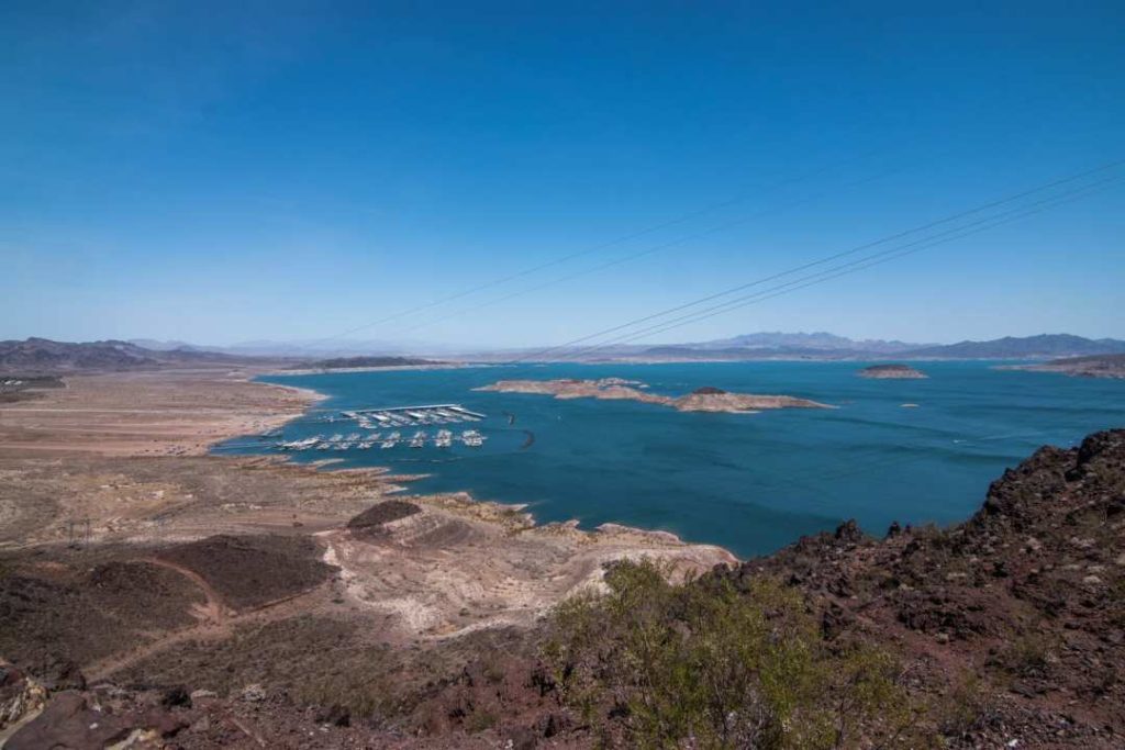
Lake Mead
On the way back from Hoover Dam to Las Vegas, we made a quick stop to see the view of Lake Mead. We then went to have lunch at the Lake Mead National Recreation Area marina for fish and chips.
- Official website Lake Mead Recreation Area
- 25 USD per vehicle, valid for 7 days
- American Pass accepted
When to go?
The high season is from May/June to September/October. It’s also synonymous with warmth! Fortunately, it’s hot and dry and not hot and humid like in Quebec. If you are planning to go on long hikes, in my opinion, July and August are not the time to do so. The best time to not get too hot would probably be April/May and October/November.
If you want to go in winter, you will probably have milder temperatures. Make sure you’re well informed about the parks that you wish to visit. For example, in Yellowstone National Park, many roads are closed in the winter. Even though it is the desert, it sometimes snows during the winter months.
I invite you to consult the official website of the national parks (NPS) for information. For State Parks (not part of the National Parks), you will have to check their own websites for information.
Set your itinerary
Google Maps, your best friend!
Once you’ve decided which parks to see, head to Google Maps! You will be able to estimate how much time there is between each location and as a bonus, it will tell you if there are any closed roads (in real time). It will always take the shortest route. Always check and adjust the displayed itinerary according to the road you want to take.
Choose your point of departure and point of arrival versus the cost of the plane ticket
In order to determine my arrival and departure point, I had to do a lot of testing in the search engines for buying air tickets.
After doing research for airports near your arrival point, you also have to look at whether the price of the car rental makes sense. For example, I chose to land in Bozeman, Montana, because the price was exorbitant if I landed in Cody. We didn’t save any time either, as there were 2 stopovers. There wasn’t much choice of vehicles since I didn’t bring back the car to the same place. This is often the case with small airports.
After my research, I decided to land in Bozeman, Montana and depart from Las Vegas.
Bozeman was a good choice as it is a 2 hour drive from the north entrance of Yellowstone Park. The flight time/price ratio was excellent compared to Cody or Jackson.
Useful blogs
There is a lot of information and travel experiences on the web about the American West. Here’s a list of the ones that caught my eye, that helped me pick places I’m interested in:
Budget
First of all, we were 4 people. Our trip lasted 14 days and we covered 3,000 km.
We have therefore split the costs of car rental, gas, food (except restaurants), park entrance fees and accommodations. Prices are in Canadian dollars (June 2018 exchange rate at approximately 77 cents).
| Expense | Amount per person |
| Plane | 629 $ |
| Accommodation | $ 632 |
| Rental cars | $336 |
| Gas | $62 |
| Grocery | 155 $ |
| Restaurants | 388 $ |
| American Pass | $27 |
| State Park Pass | $15 |
| Jenny Lake Ferry | 12 $ |
| Las Vegas Taxi | $6 |
| Total | 2 263 $ |
In terms of credit card points: I redeemed my Scotiabank Visa Infinite Passport points for a portion of the airline tickets.
And, when I was there, I paid most of the time with this card without any currency conversion fees (a 2.5 % saving on each purchase).